Restoration Strategic Plan of Watercourses
in Region 3 of Tehran Municipality
Project Info
| Year: |
| Type: |
| Program: |
| Client: |
| Size: |
| Location: |
| Status: |
| 2018 |
| Commission |
| Strategic Plan |
| Tehran Municipality Organization (TETCO) |
| 400 hectares |
| Tehran, Iran |
| Completed |
| Project Management: | Shadi Azizi |
| Lead Designer: | Ali Naghavi Namini |
| Project Coordination: | Shadnaz Azizi |
| Environmental Studies: | Yalda Seirafi, Shadnaz Azizi, Mahdi PourPeykari, Mojtaba Safdarnejad, Mozhdeh Mahdavi Moghadam, Ahmad Khoshdel Nikoo, Tiam Sharifi, Somayeh Esmaili |
| Social Studies: | Mohammad Ameli, Marjan Shojaie |
| Design Team: | Tiam Sharifi, Mozhdeh Mahdavi Moghadam, Nastaran Esmaeel Beygi, Farshad Kazerooni, Mohammadtaghi Dibaee, Mahdi PourPeykari, Somayeh Esmaeeli |
| Presentation: | Masoumeh Hosseinzadeh |
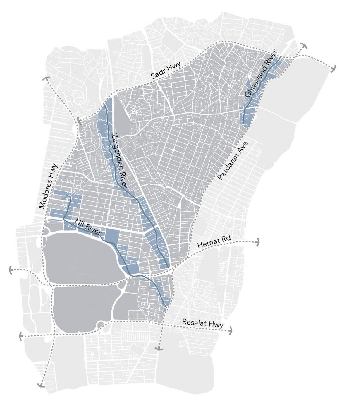
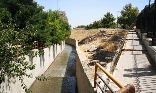
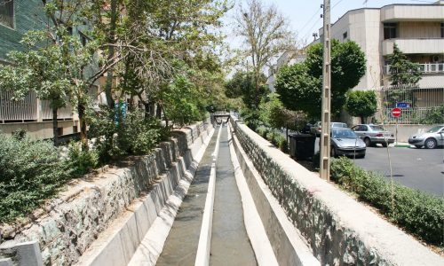
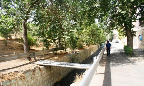
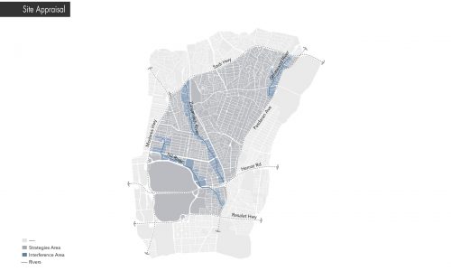
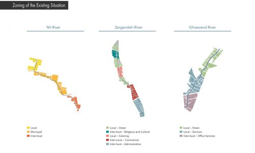
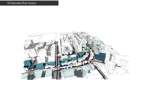
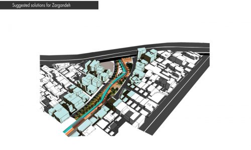
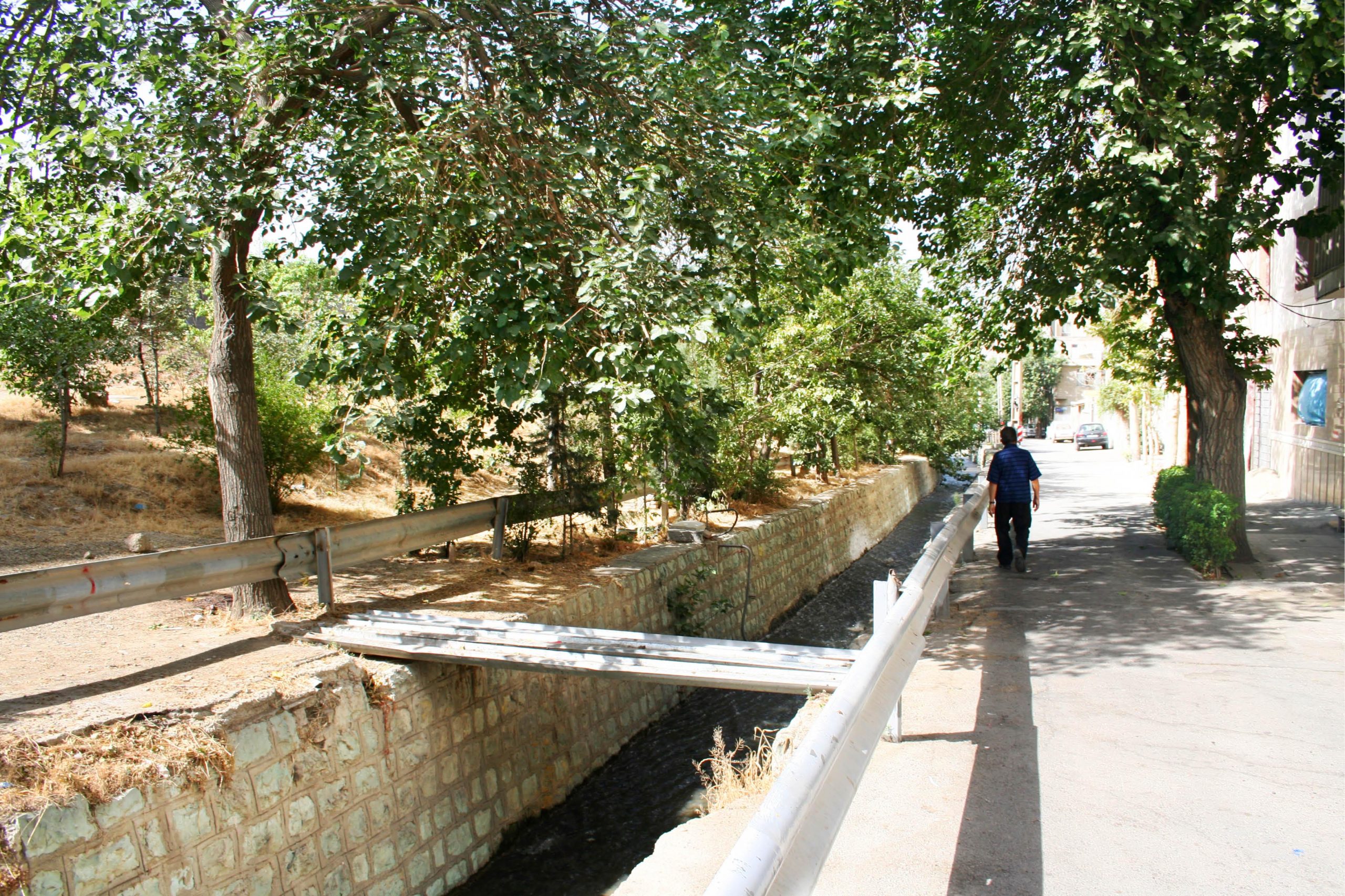
With the constant development of Tehran during the recent years, intermittent streams that had formed the structure of the city – and were once a blessing for urban life – are now considered as an environmental threat. Flooding issues caused by the immethodical constructions and poor management of the urban spaces has forced the municipal authorities to confine Tehran’s intermittent streams into concrete walls. These decisions for the management of the urban water basins gradually restructured Tehran. In this new spatial structure, perennial and intermittent streams were covered and constrained in concrete walls and so disappeared from the life of the citizens. The intermittent streams restoration plan was conducted by the Municipal region 3 of Tehran (Ghiasvand, Zargandeh, Nil) with the goal of establishing dynamic interactions between intermittent streams and the citizens with the approach of improving the ecological quality of the waterflow and ease of movement and accessibility.
The goal of this project is to save, restore, and conserve the intermittent streams of the Municipal District 3 –Ghiasvand, Zargandeh, and Nil.
in the first place should be able to protect their own existence and in the second step, balance with the artificial environment and inject life into the urban environment. The main goals of the project can be summarized in three articles:
-Restoration of the natural shape and function of urban rivers
-Integration of the urban fabric with the intermittent streams
-Boldening the role of the intermittent streams in the spatial organization of District 3
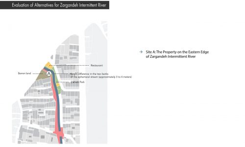
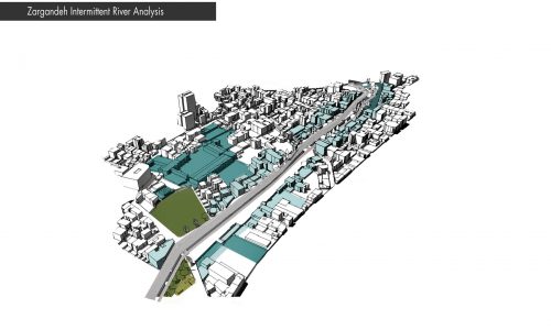
Generally, the project is carried out in a 5-level process in the form of a hierarchical spatial structure of integrated restoration of intermittent streams. Affecting spatial levels of the intermittent streams’ characteristics are: macro level (including Tehran city and the drainage basin of Zargandeh intermittent river), immediate area (including social, physical and spatial, hydrological, physiographical, and natural resources in Tehran’s Municipal District 3 area), direct intervention area (homogenous areas for urban planning, natural, and public participation) and special direct intervention area (spots with special opportunities for riparian restoration)
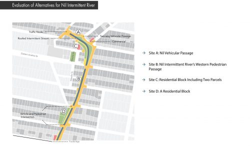
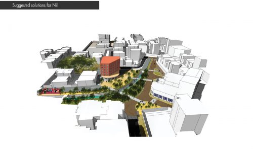
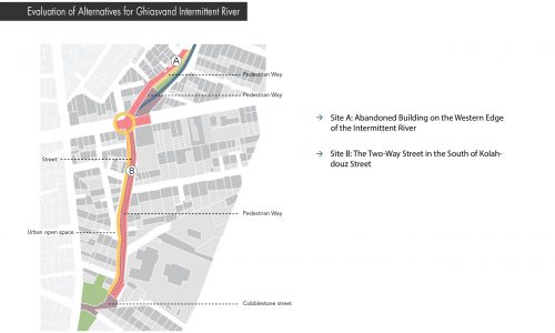
Site A: Nil Vehicular Passage
Goal: Reducing the role of the vehicular passage in the neighborhood
Solution: Because of the high costs of cobblestone paving in this area, there are only the two solutions to reduce the role of Nil passage in the neighborhood, namely, “reducing the vehicular width to at least 6 meters” and “establishing a one-way street from Takharestan to Eastern Pirouz St.”.
Site B: Nil Intermittent River’s Western Pedestrian Passage
Goal: Dedicating the western passage of the intermittent river to the main local pedestrian axis which connects the neighborhood center to Mirdamad axis
Solution: Providing the axis with appropriate pavement and furniture, minimum pedestrian width is 3.5 meters and minimum green spaces margin width is 1.5 meters.
Site C: Residential Block Including Two Parcels
Goal: Stimulating the development of the neighborhood center and creating social spots in connection with the neighborhood center
Solution: Community service projects can be defined in this spot by mixing the solutions of “activating the ground floor” and “creating opportunities for investors to define mixed-use projects” which creates the opportunities to release the lower floors and reinforce the connection of the project with the neighborhood center. Also, this provides the necessary services of the neighborhood in the upper floors
Site D: A Residential Block
Goal: Creating liveliness and environmental and spatial diversity aligned with the pedestrian axis and granting the natural qualities of the neighborhood to the pedestrians
Solution: “Releasing the land lot for the public profit” will be exorbitant because of the acquisition cost of the properties. Thus “releasing a part of the yard of the land lot for the urban space uses” can be used as an in-between solution. Considering the presence of a maintainable building in the property, transparency of walls and use of fences will also affect the privacy of the aforementioned building.
مسیل غیاثوند با نقش محور سبز فعال محلی، مسیل زرگنده به عنوان محور تفرجی پیاده پشتیبان خیابان شریعتی و مسیل نیل با عملکرد محور سبز مرتبطکننده عناصر فرهنگی- ورزشی؛ به عنوان مسیرهای سبز منطقه ۳ تعریف شدند که با مجموعه ای متنوع از پارک ها، مسیر های پیاده، فضاهای شهری و فعالیت های پذیرایی و خدماتی، محورهای جذاب پیاده روی را برای ساکنین محل و منطقه ۳ شهر تهران مهیا میسازند.
به طور کلی پروژه در طی فرآیندی ۳ سطحی در قالب یک ساختار فضایی سلسله مراتبی ساماندهی یکپارچه مسیل ها دنبال شدهاست. سطوح فضایی تأثیرگذار بر خصوصیات مسیلها عبارتاند از: حوزه کلان (شامل شهر تهران و حوزه آبخیز مسیل زرگنده)، حوزه بلافصل (در برگیرنده مرزهای اجتماعی، حرکتی، کالبدی و فضایی، هیدرولوژی، فیزیوگرافی و منابع طبیعی در محدوده منطقه ۳ شهرداری تهران)، حوزه مداخله مستقیم (گسترههای همگن به جهت حوزههای شهرسازی، طبیعی و مشارکت مردمی) و حوزه مداخله مستقیم ویژه (لکههایی با فرصتهای ویژه جهت ساماندهی رودکناری).
موضع الف: معبر سواره نيل
هدف: كم كردن نقش معبر سواره نيل در محله
راهكار: به دليل هزينههای زياد كفپوشها در اين موضع صرفا از راهكار كاهش عرض سواره به حداقل ممكن ۶متر و يک طرفه كردن مسير از بهارستان تا كوچه پيروز شرقی در جهت كمرنگتر كردن معبر نيل در محله استفاده شدهاست.
موضع ب: معبر پياده غربی مسيل نيل
هدف: اختصاص دادن معبر غربی مسيل به محور اصلی پياده محلی كه مركز محله را به محور ميرداماد متصل میكند.
راهكار: آمادهسازی بستر محور با كفسازی و مبلمان مناسب، حداقل عرض پياده ۳.۵ متر و حداقل عرض فضای سبز حاشيه مسيل ۱.۵ متر در نظر گرفته شدهاست.
موضع ج: بلوک مسکونی شامل دو پلاک
هدف: تحريک توسعه مركز محله و تشكيل كانون اجتماعی در ارتباط با مركز محله
راهكار: با تركيب راهكار فعالکردن طبقه همكف به نفع خدمات عمومی و فضای باز در ارتباط با مركز محله و ايجاد فرصت برای سرمايهگذاران برای تعريف پروژههای مختلط مسكونی و يا پروژههای غير مسكونی و كنترل آن توسط مديريت شهری میتوان پروژه خدماتی در اين نقطه تعريف نمود كه از طرفی با آزاد ساختن طبقات تحتانی ارتباط پروژه را با مركز محله محكمتر میسازد و از طرف ديگر خدمات مورد نياز محله در طبقات فوقانی تعريف خواهدشد.
موضع د: يک پلاکمسكونی
هدف: ايجاد طراوت و تنوع محيطی و فضايی در طول محور پياده و بهرهمند شدن عابرين از كيفيت طبيعی در محله.
راهكار نهايی: به دليل هزينههای ناشی از تملک كل ملک از آزادسازی عرصه ملک به نفع عموم به عنوان راهكار بينابين میتوان استفاده كرد. ( قسمتی از حياط مجموعه فوق را درخدمت فضای شهری آزاد نمود) با توجه به حضور يک ساختمان قابل نگهداری در اين ملک، شفافسازی ديوارها و استفاده از حصار يا نرده نيز حريم شخصی ساختمان مذكور را تحت شعاع قرار خواهدداد.
