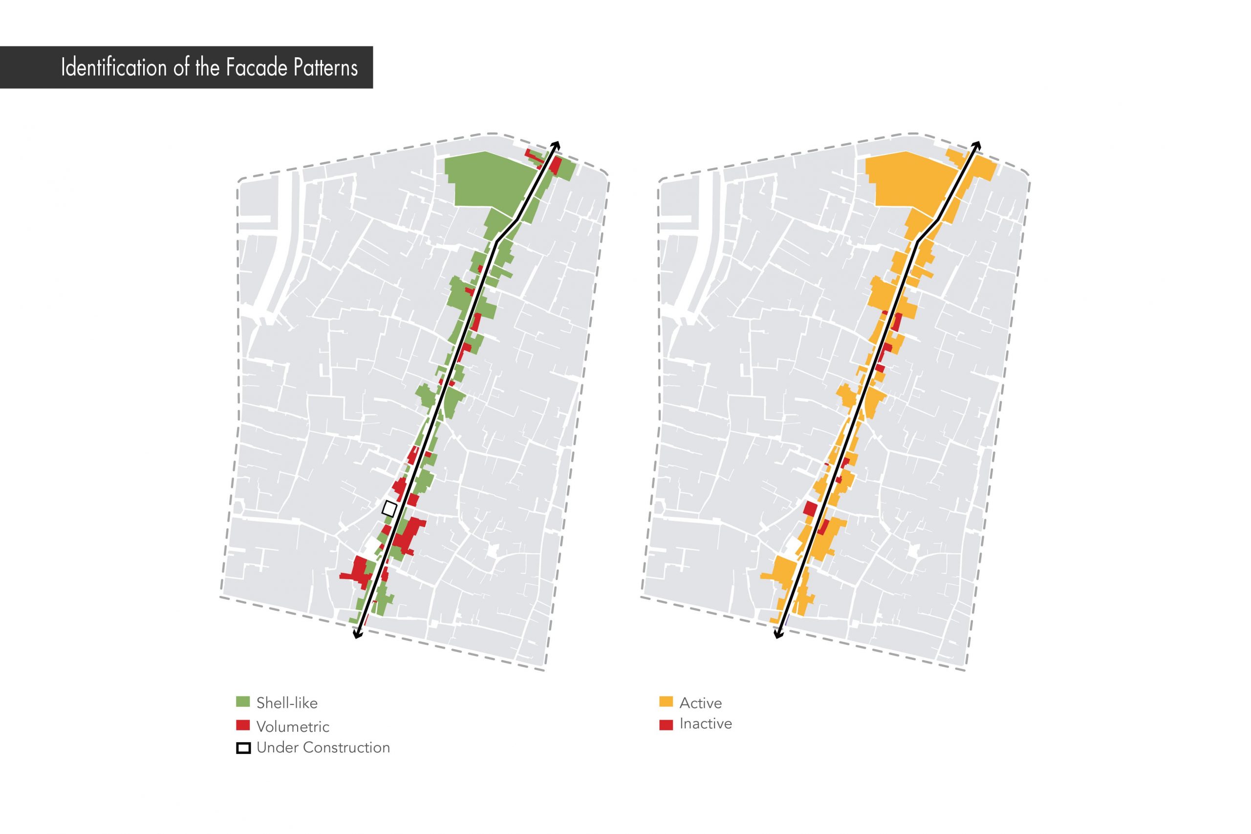
International Trade Fairs of Yazd
Project Info
| Year: | 2021 |
| Client: | Yazd International Trade Fair Company |
| Location: | Yazd, Iran |
| Status: | Ongoing |
| Program: | New Developments |


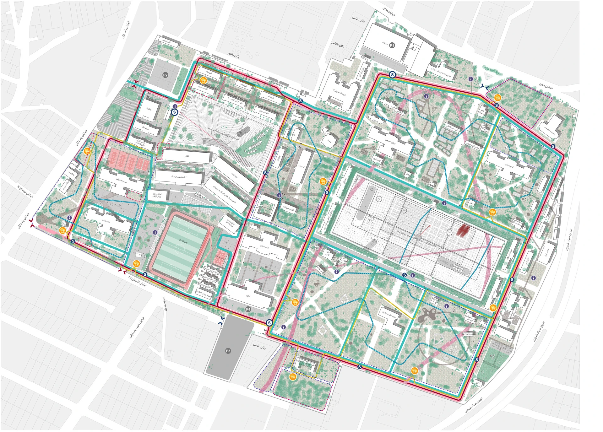
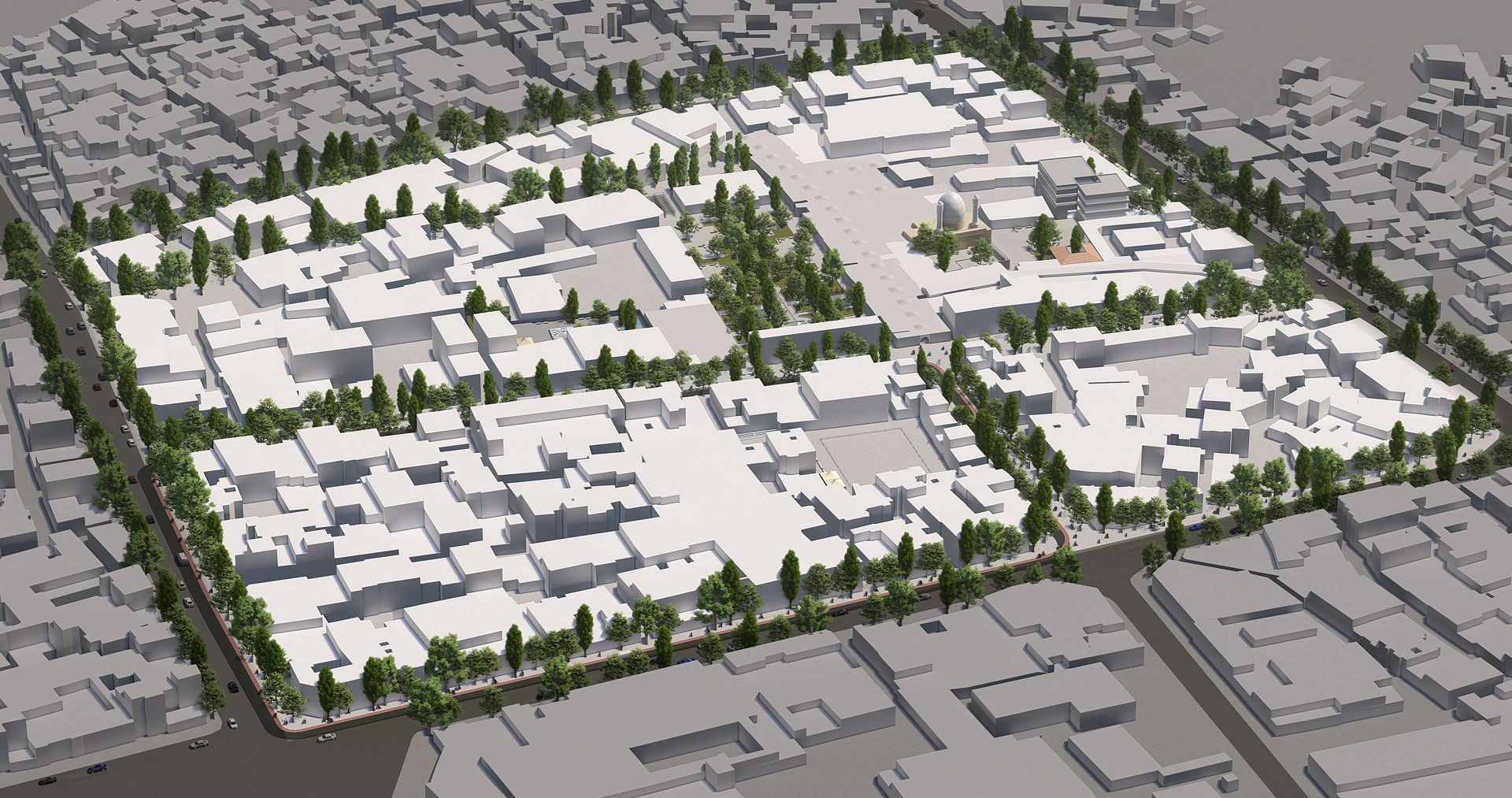
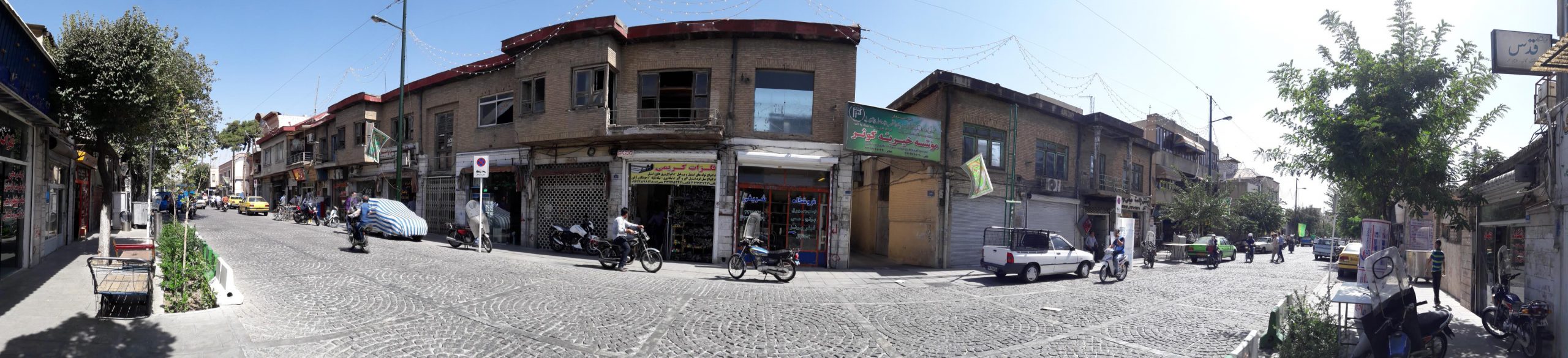
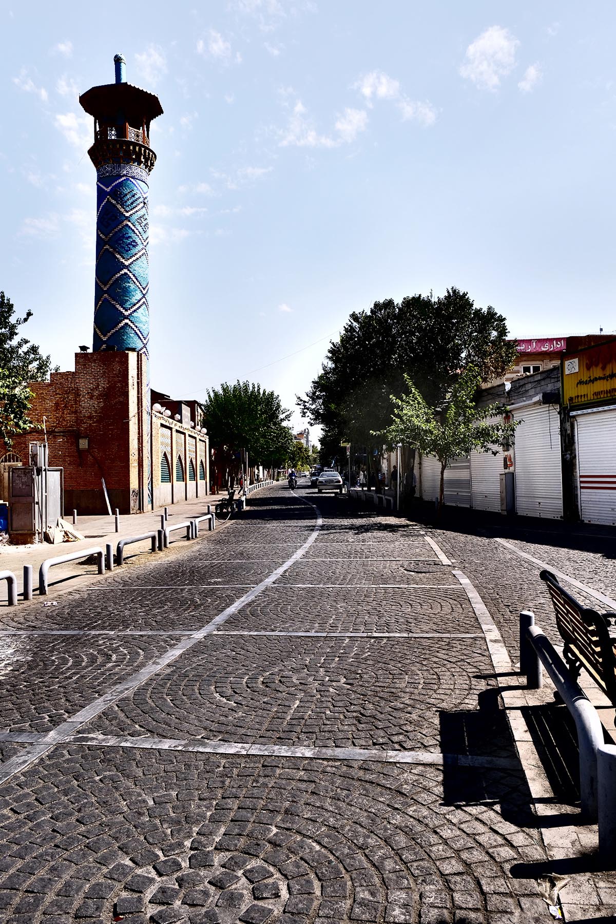
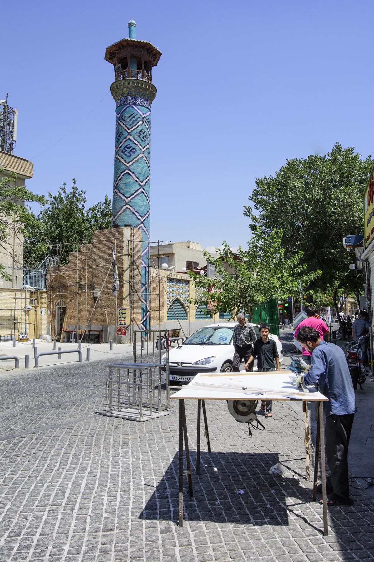
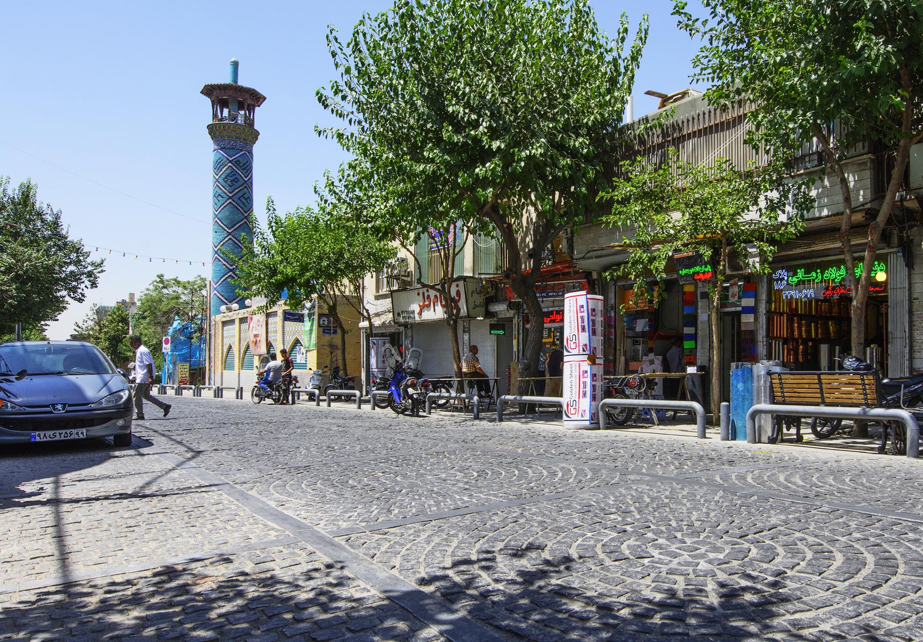
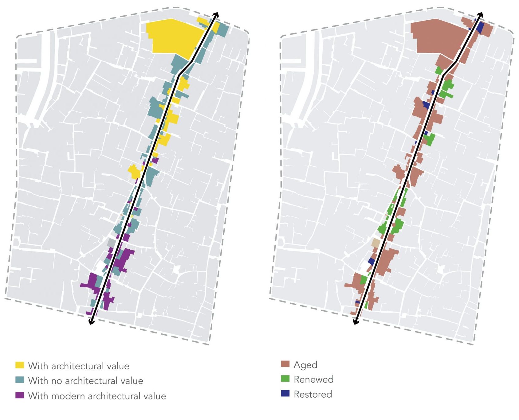
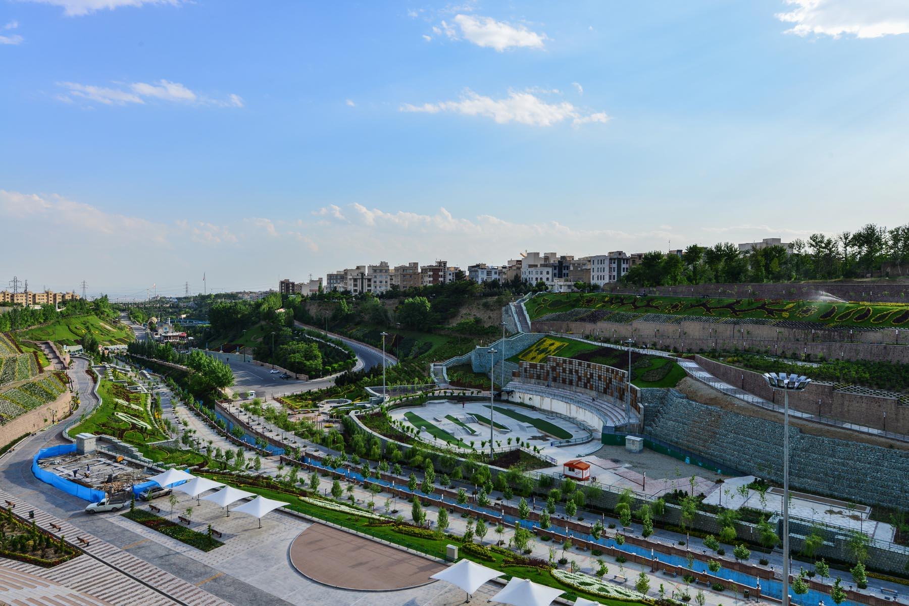
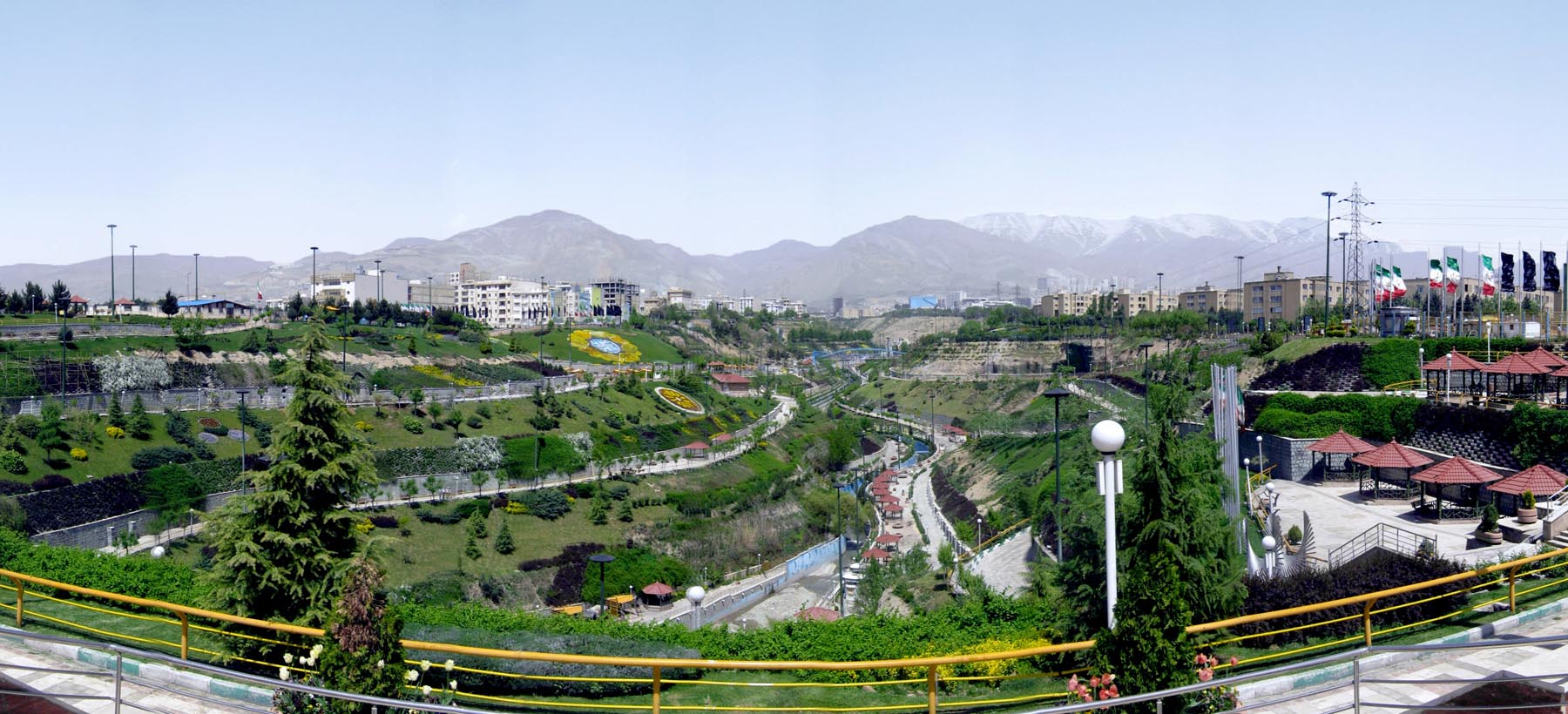
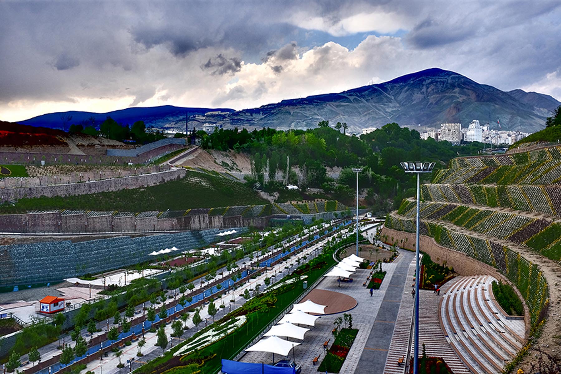
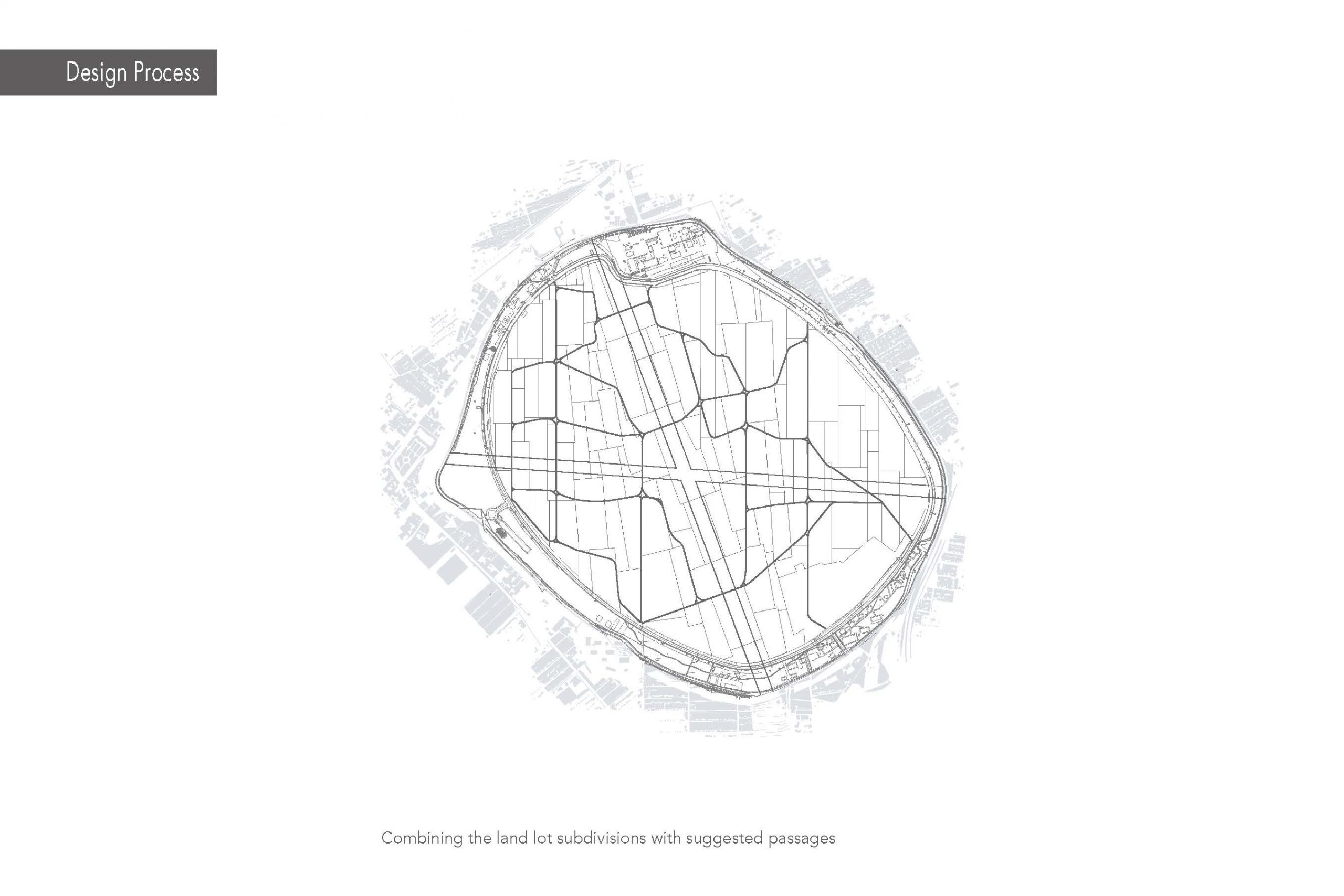
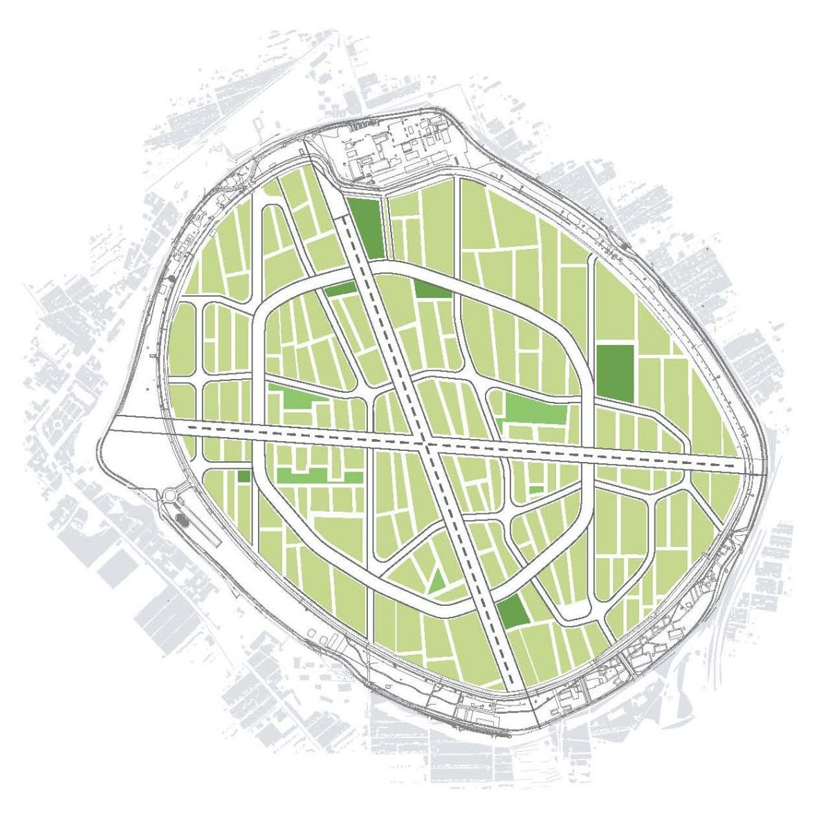
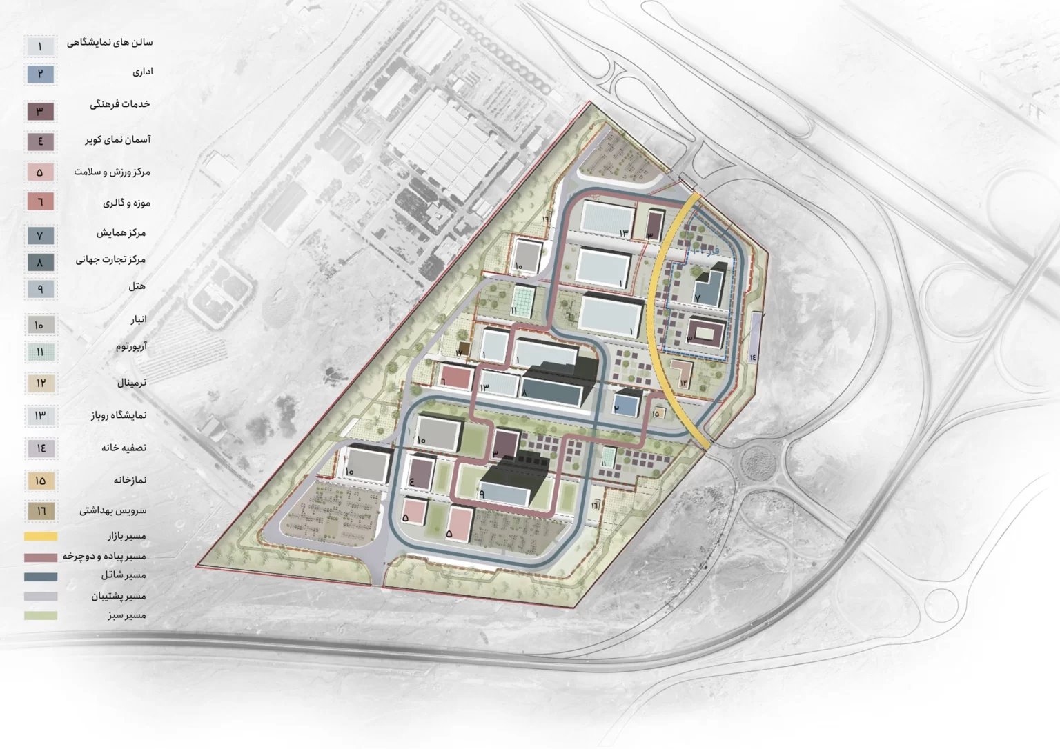
Yazd International Trade Fair plan’s main task is the large-scale (56 ha) vacant site development, located in the south of the historical city’s limits of Yazd. Our mission in this project was to prepare a Strategic Plan bringing feasibility and conception into focus; A Spatial Masterplan and a Landscape Plan for main open and public spaces with the image of a new and contemporary business district for Yazd, devoted to Trade Exhibitions and Cultural Events. Considering the nature of Exhibitions as a meeting point for exchange and interaction both at specialized levels and in general sectors, and relying on the capacities and facilities within the city, this development would certainly act as a stimulus for the growth of activities and infrastructures by increasing the demand for them, especially those that have a compatible or complementary nature to the exhibition activities.
Design values followed in Master planning process are to maintain social continuity and cohesion and effective communication with the local community, aiming for a balanced and asset-based economic growth both for the YITF Co. and the surrounding urban area, and create an authentic and appropriate identity in dialogue with the historical city of Yazd. Full respect and taking measures to maintain the ecosystem’s sustainability and trying to reach compatibility with natural processes are also the main underlying values framing the strategies and actions.
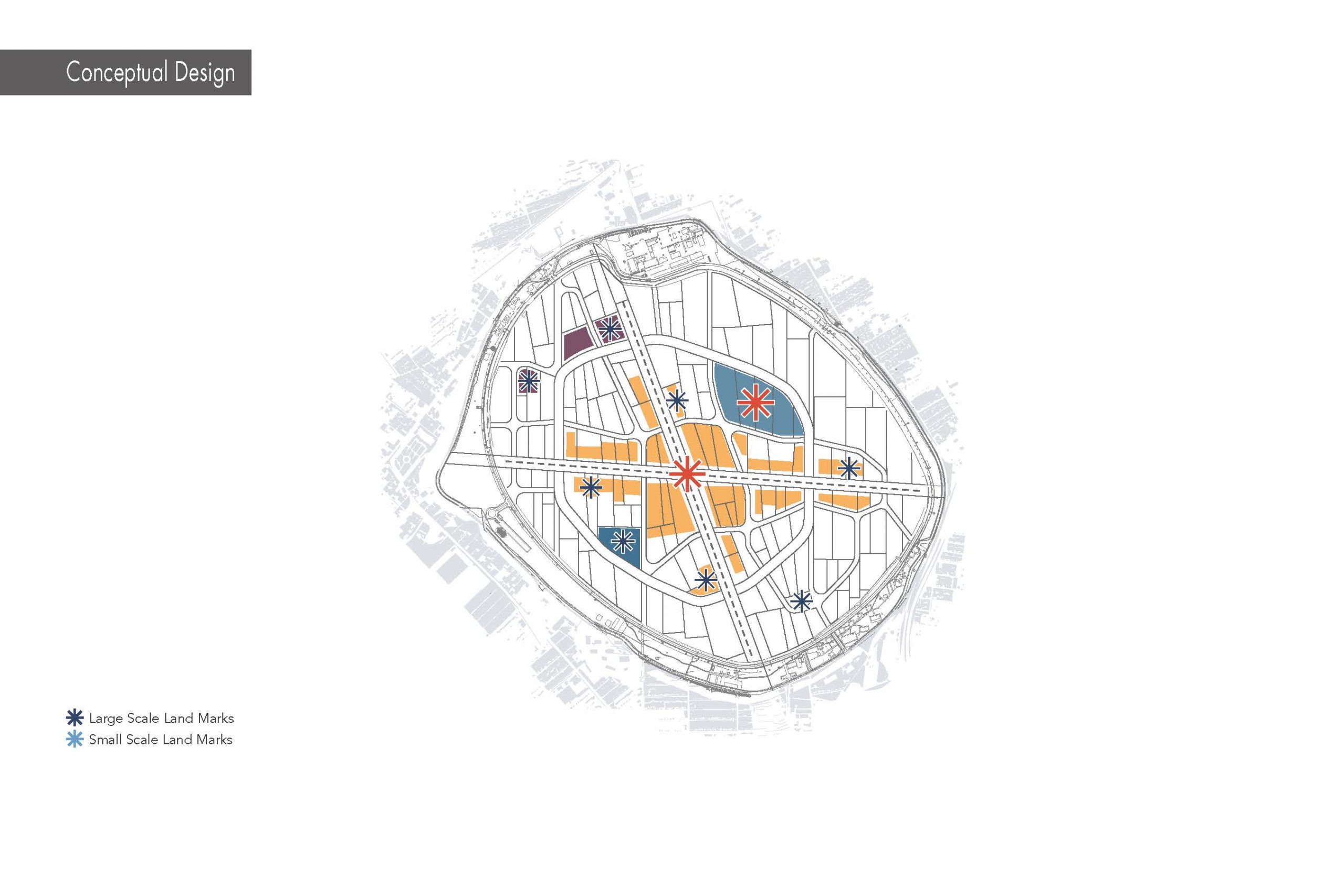
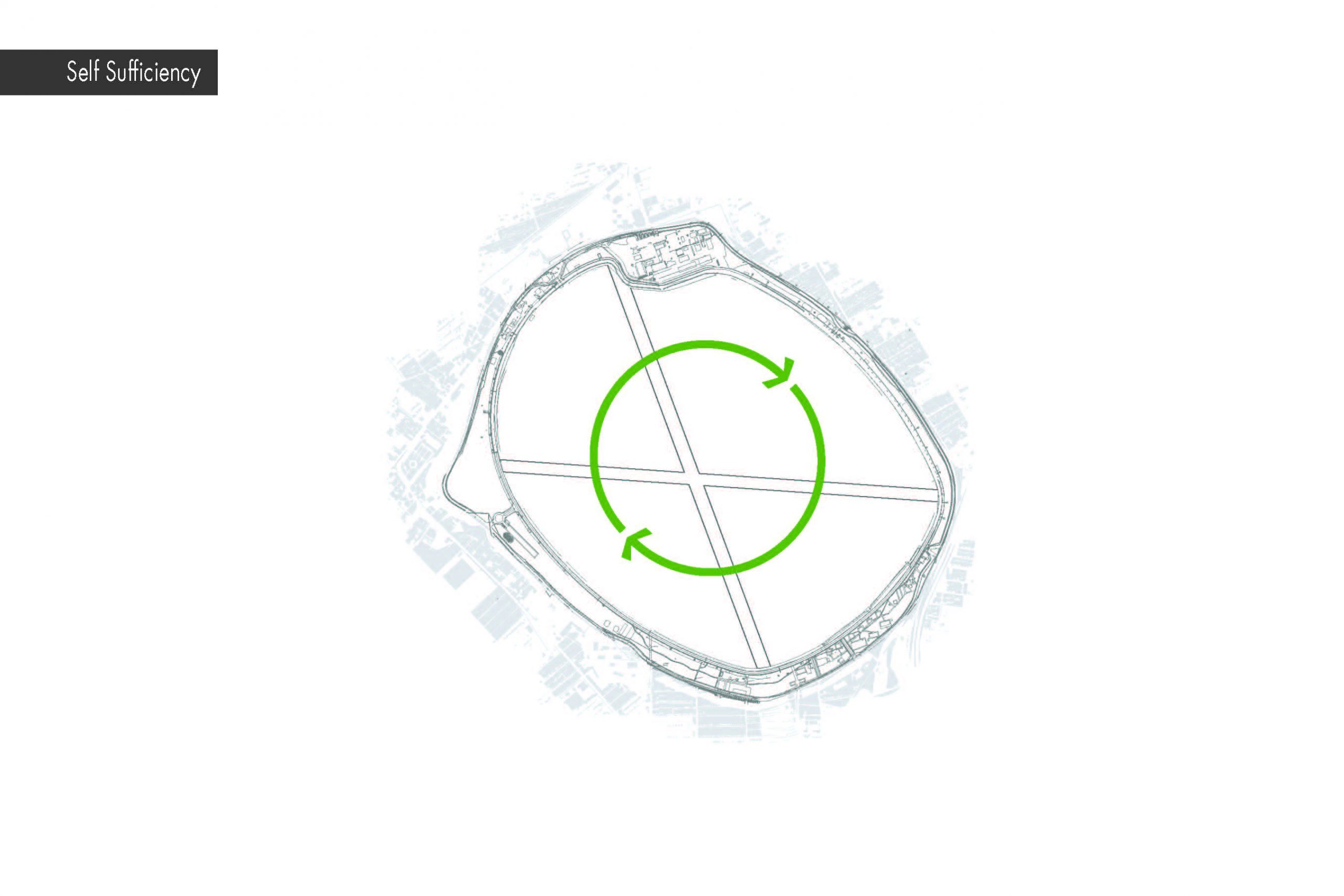
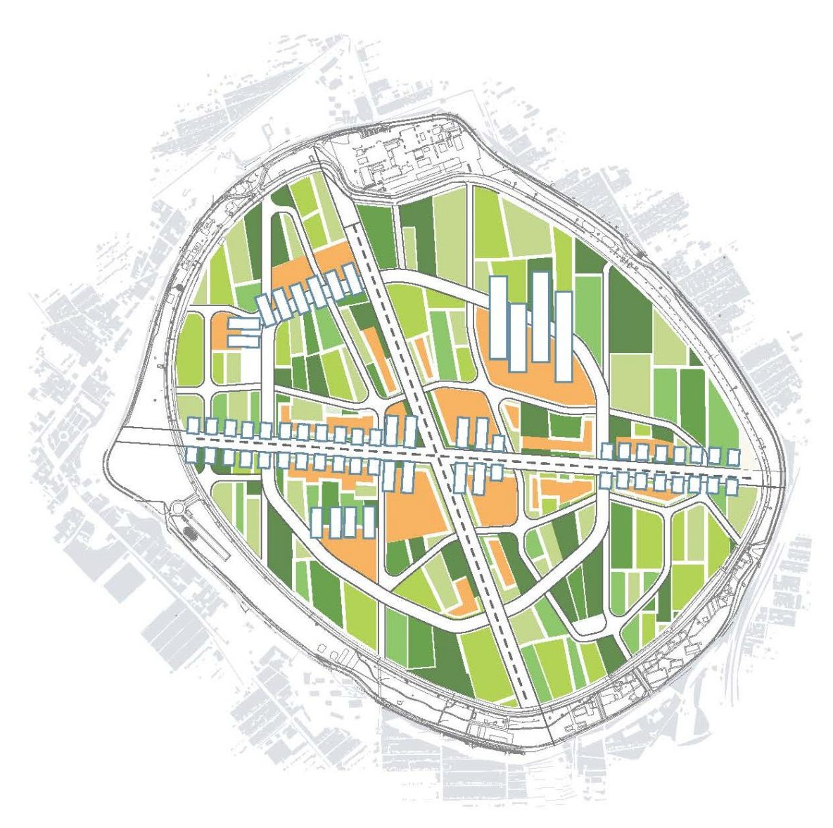
The YITF development plan focuses on the two key elements: A business model in order to lead through in Trade Fair business; and spatial development of the site to prepare a platform for the business as well as creating added value on the site as a competitive advantage in holding commercial, cultural and tourism events.
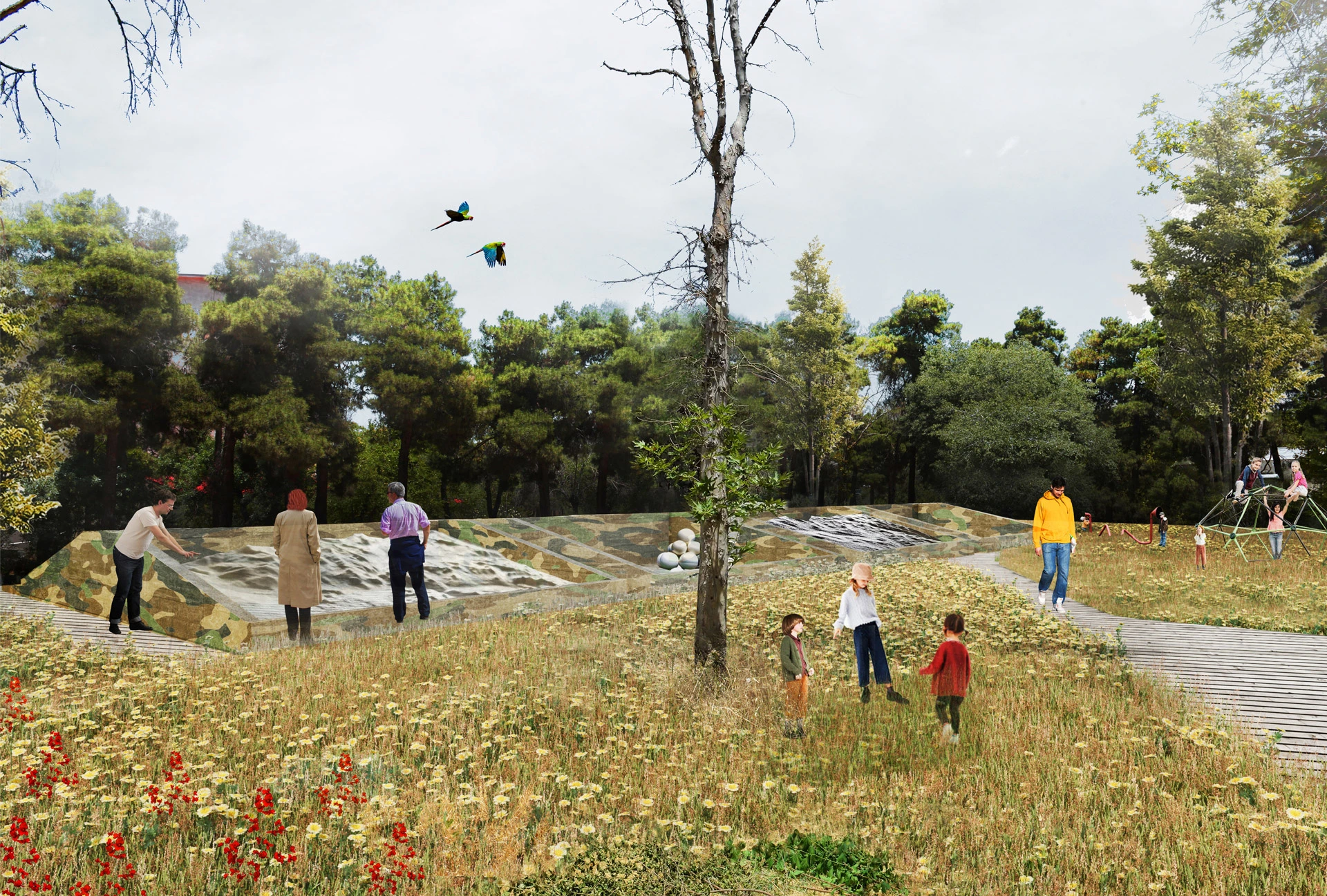
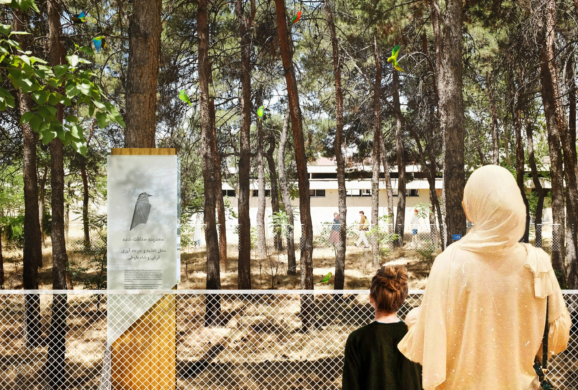
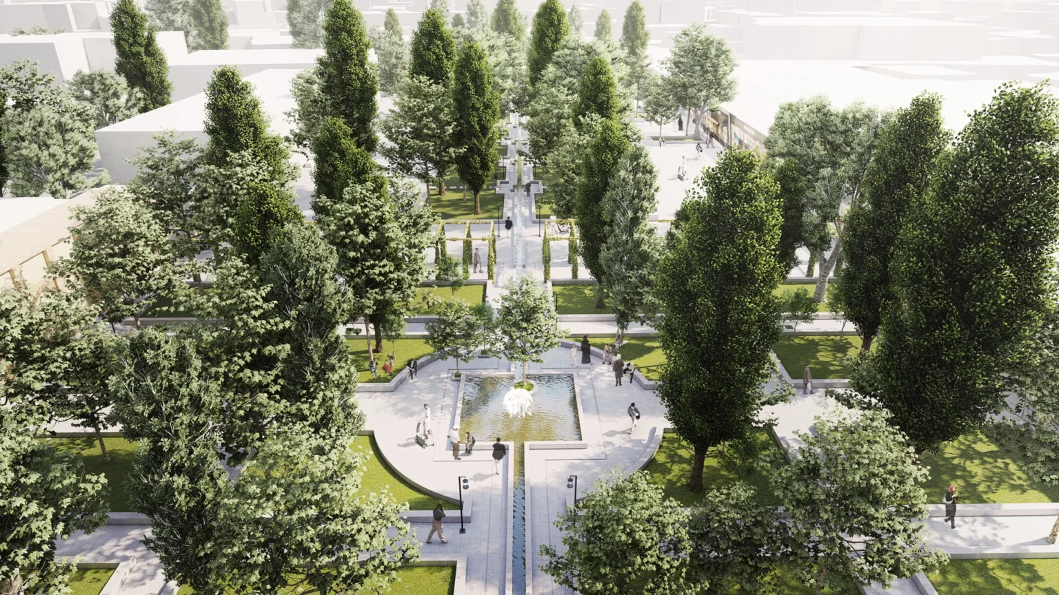
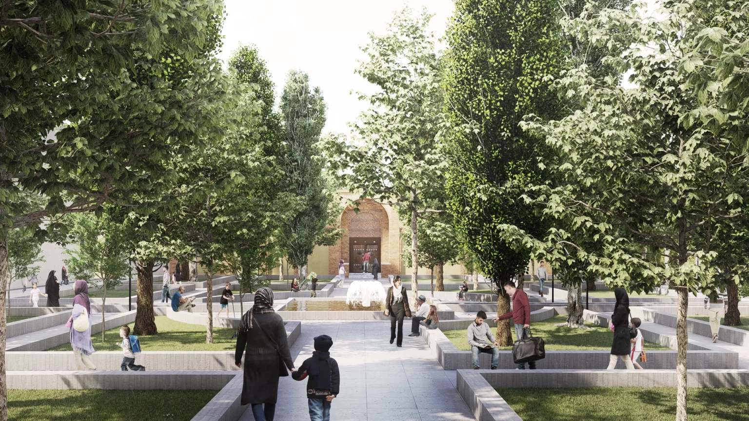
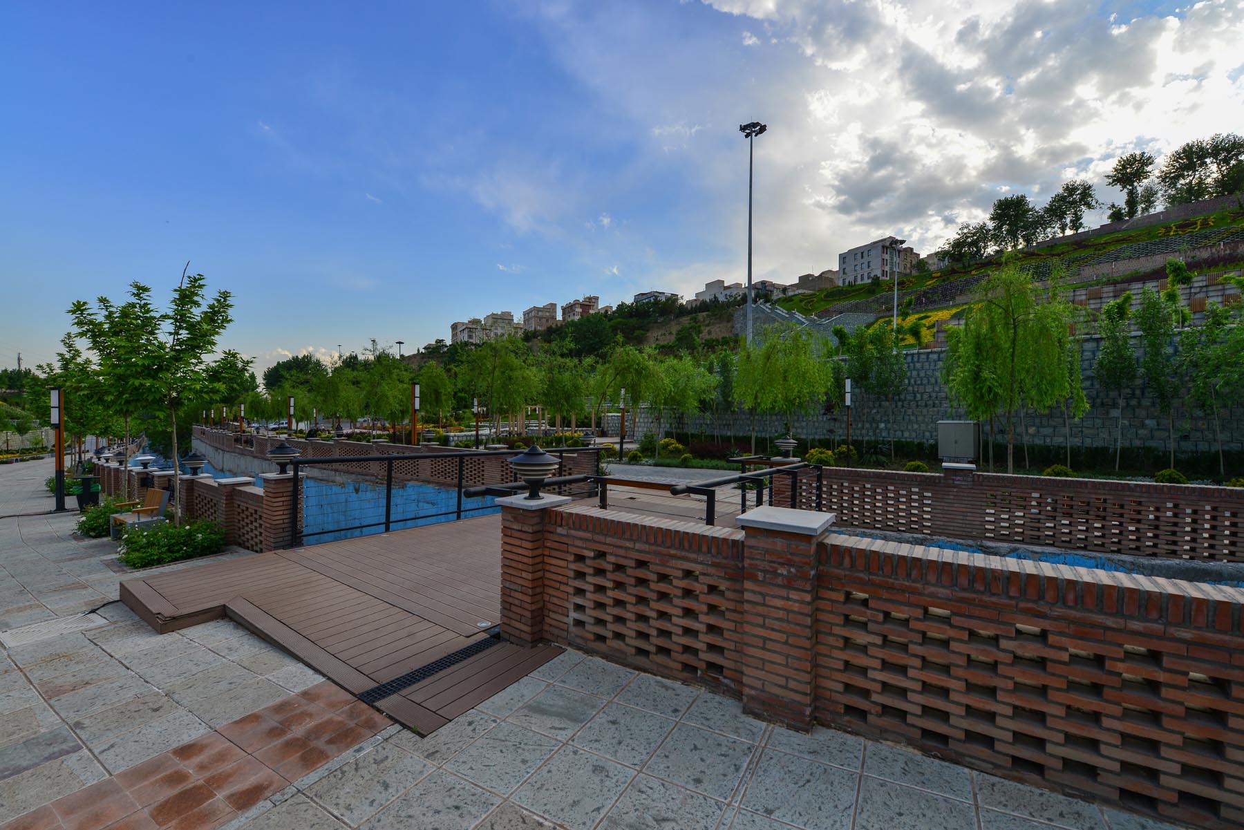
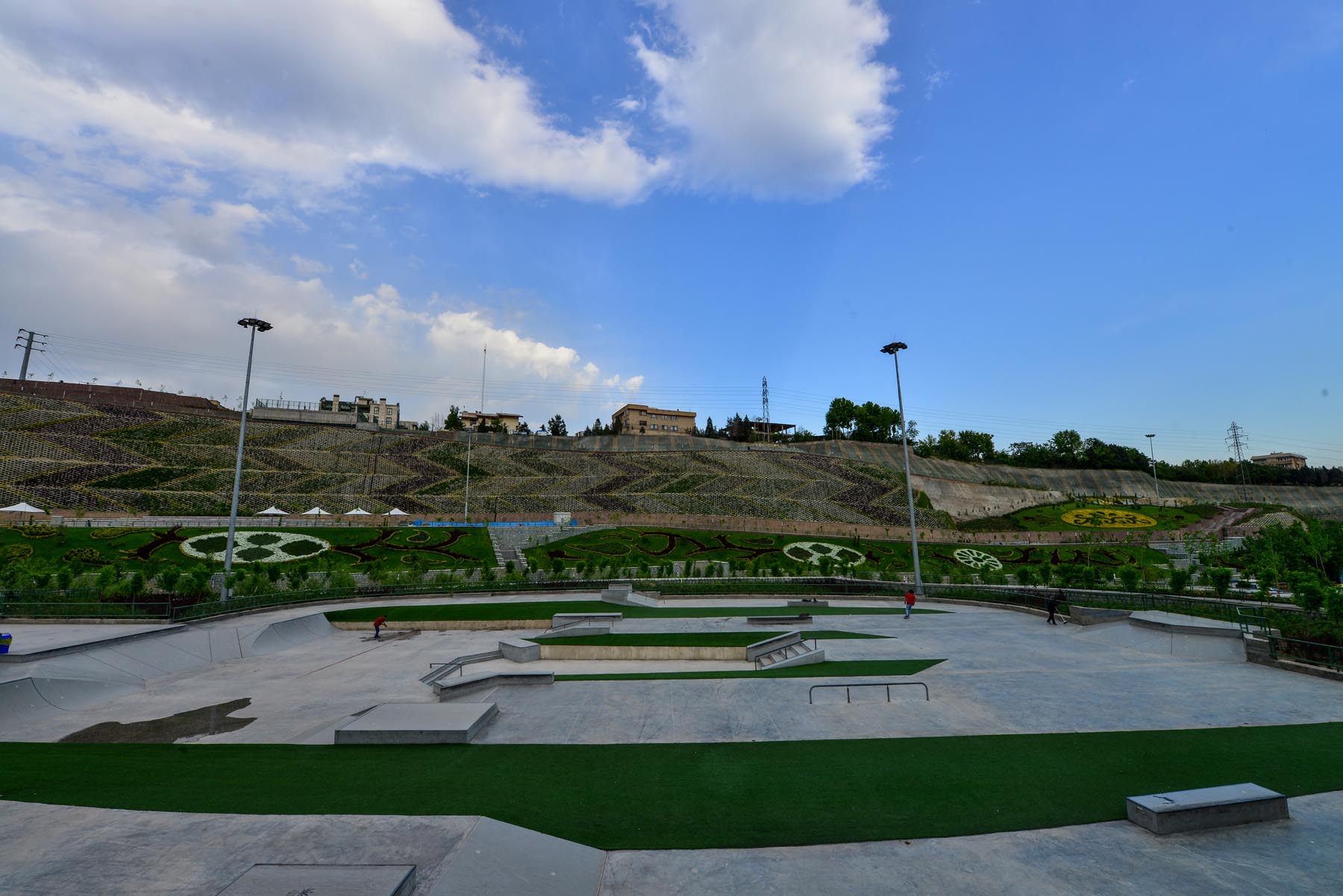
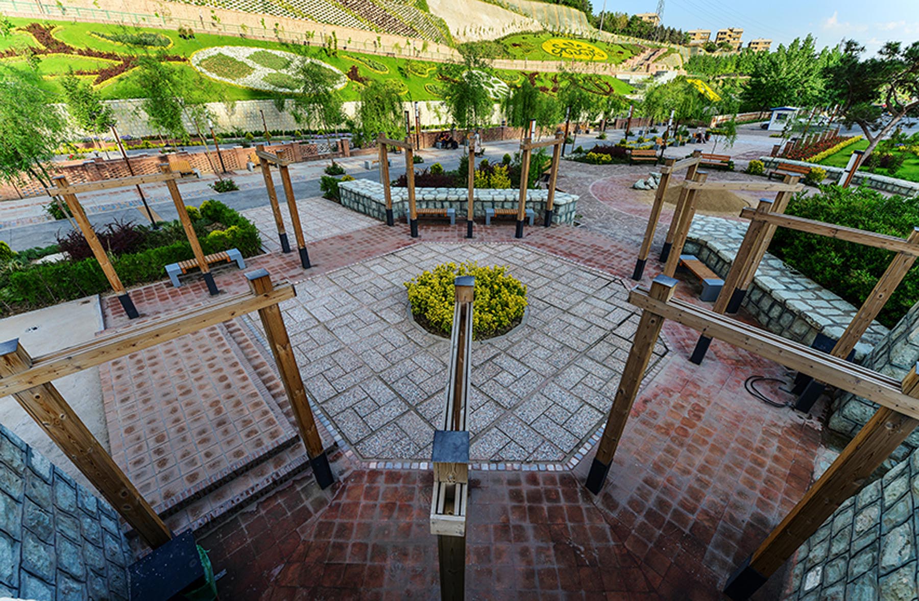
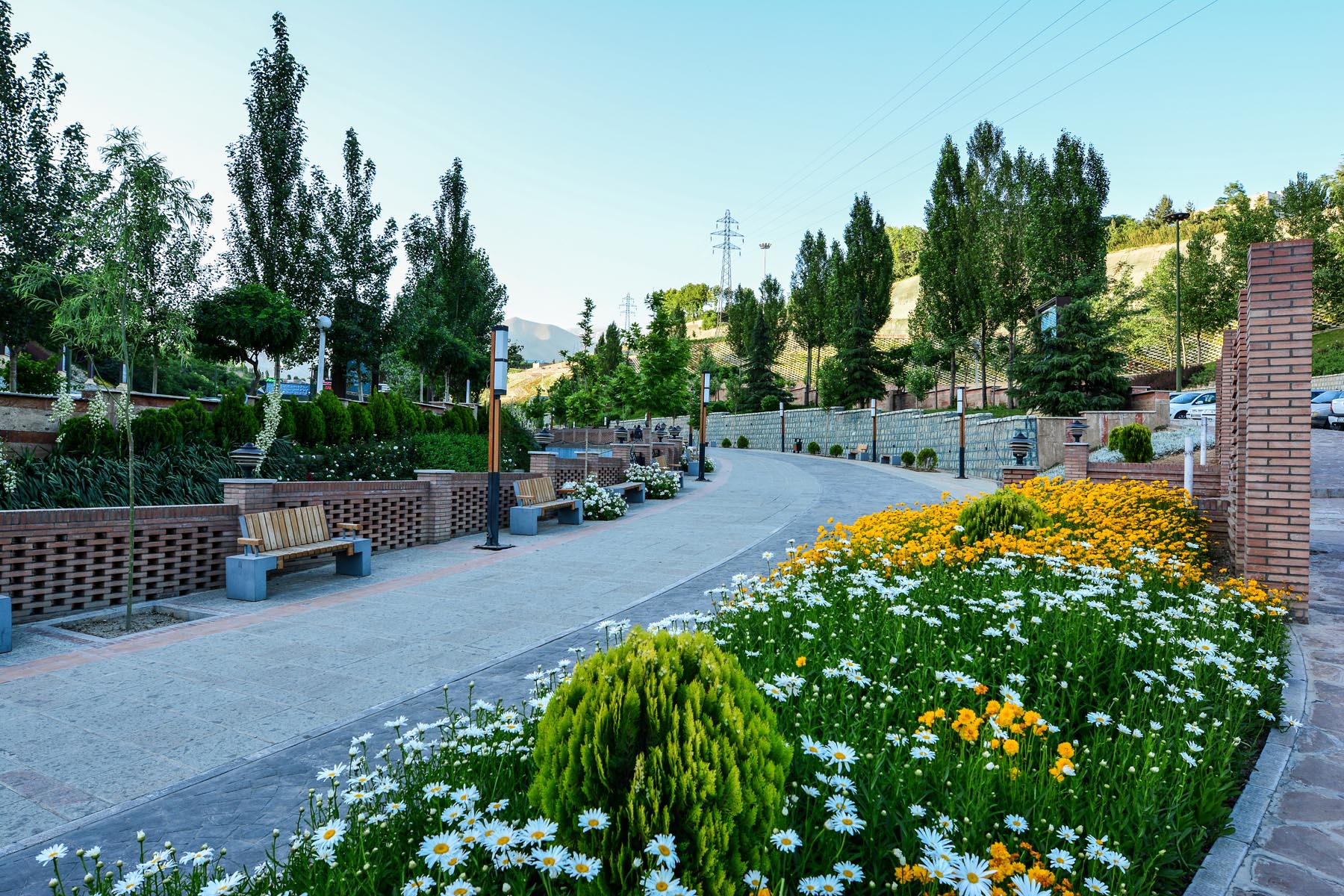
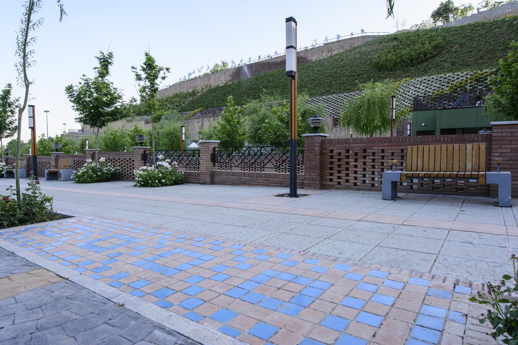
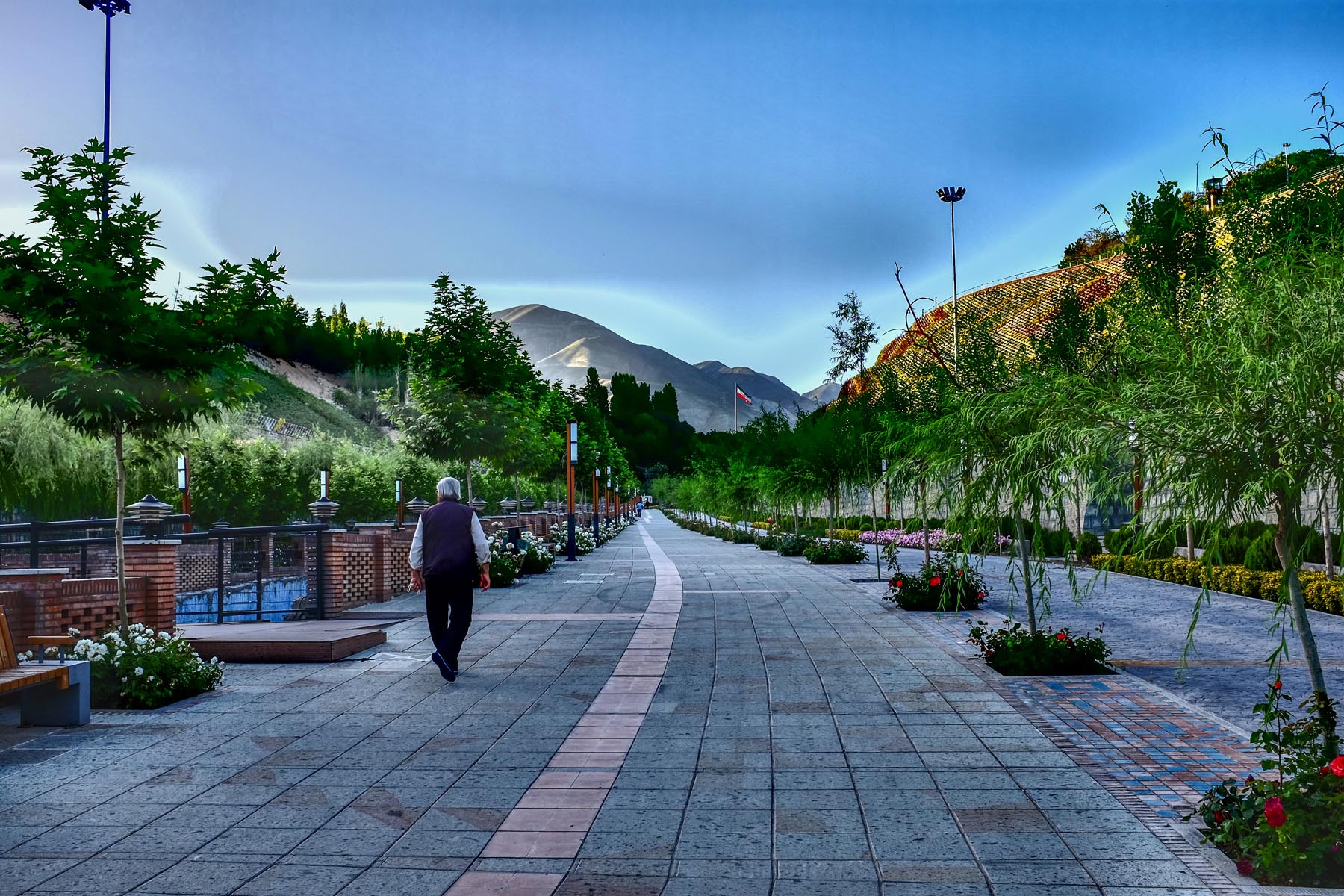
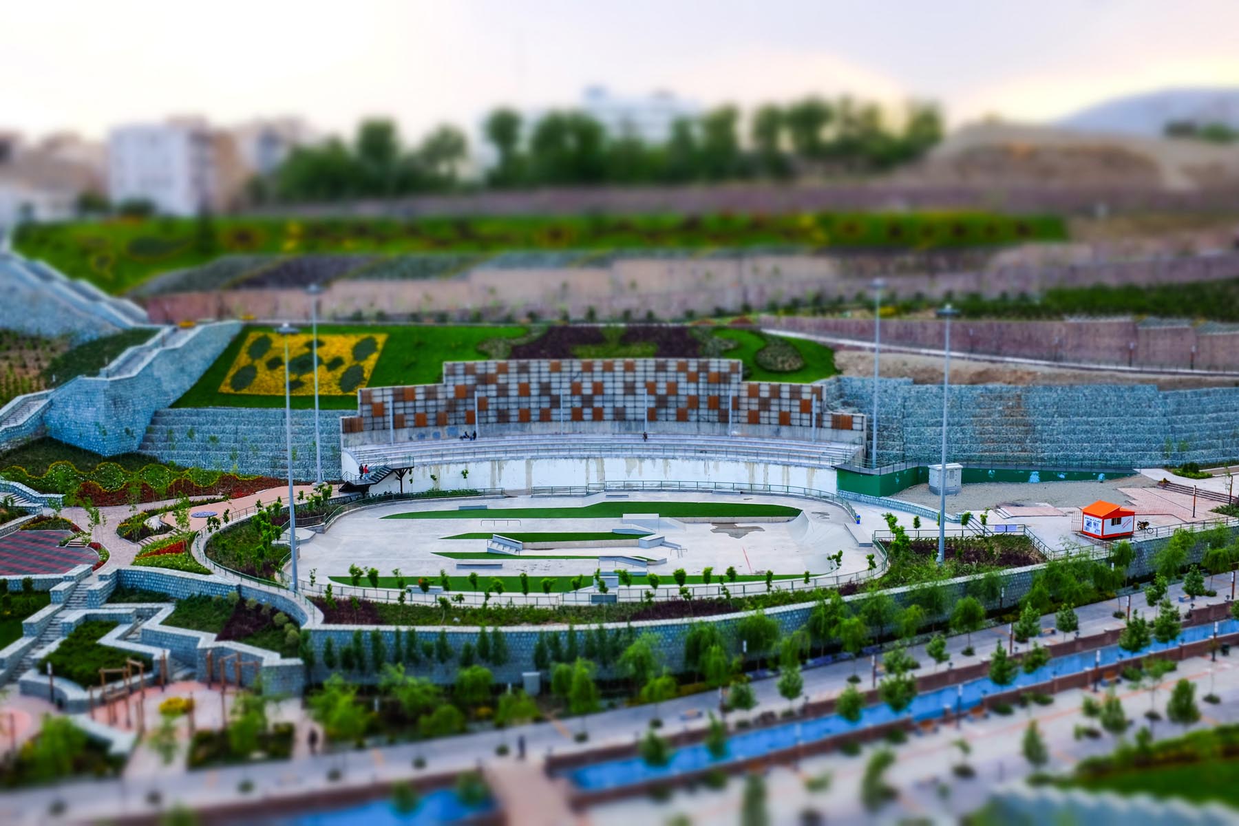
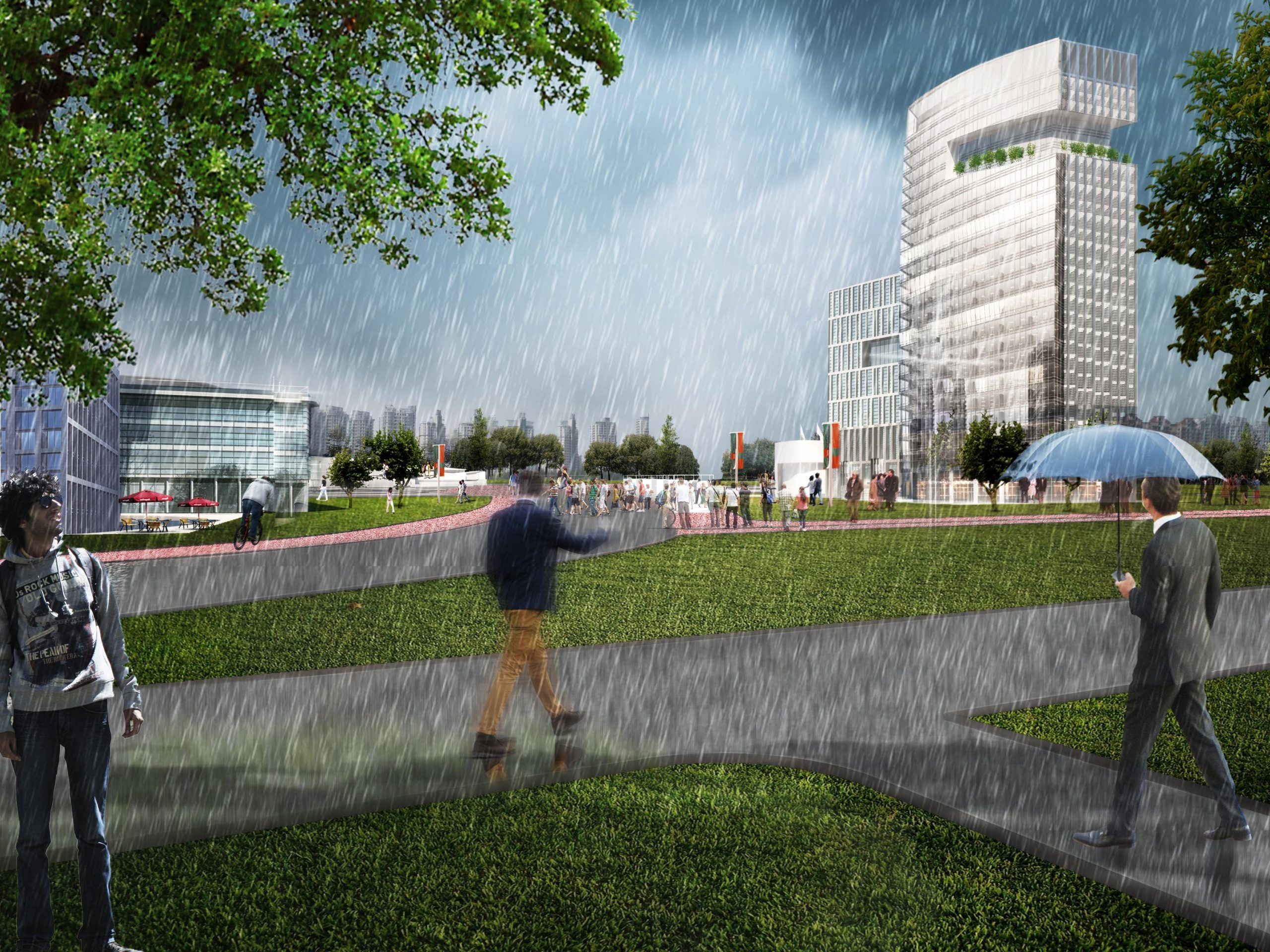
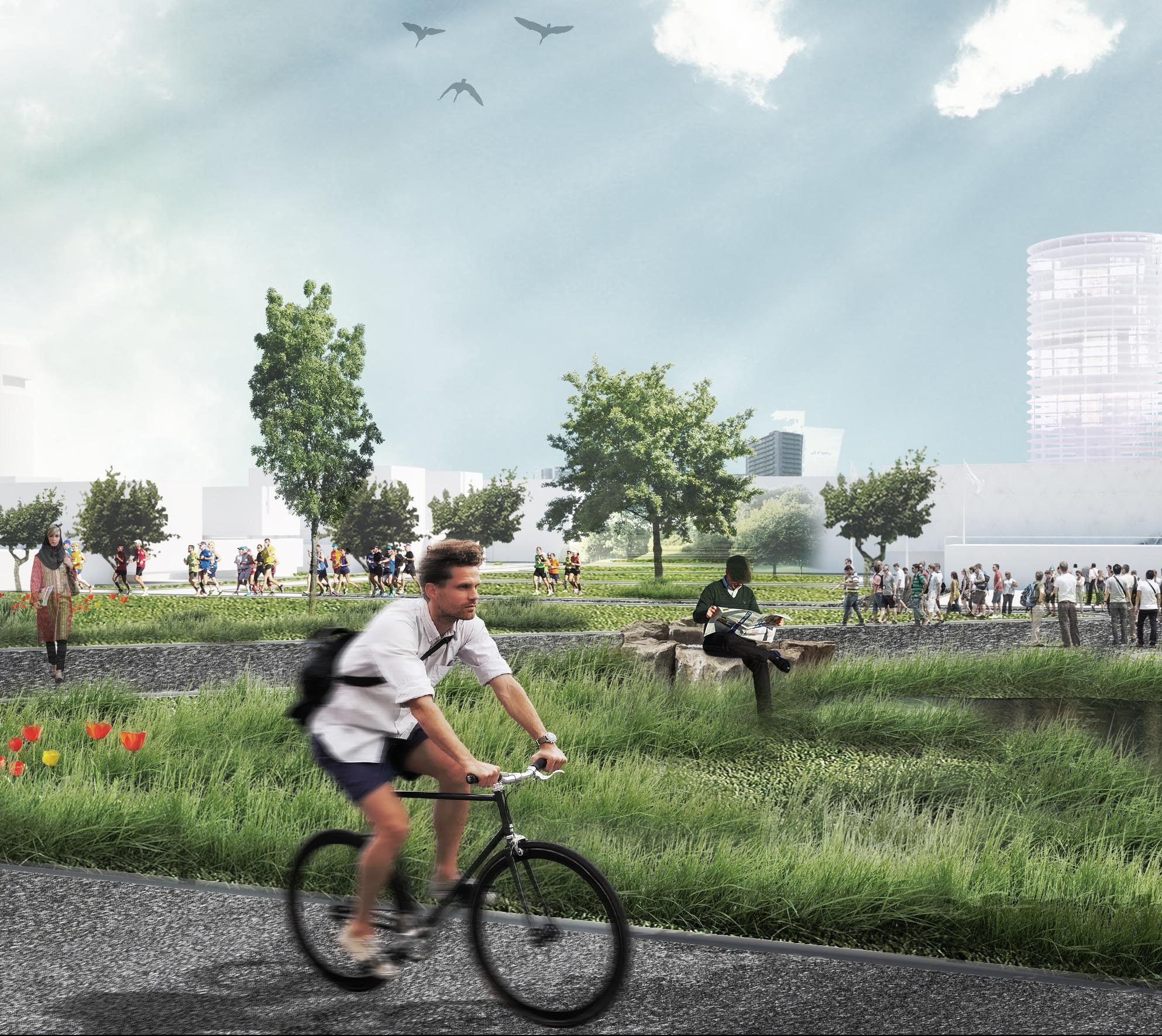
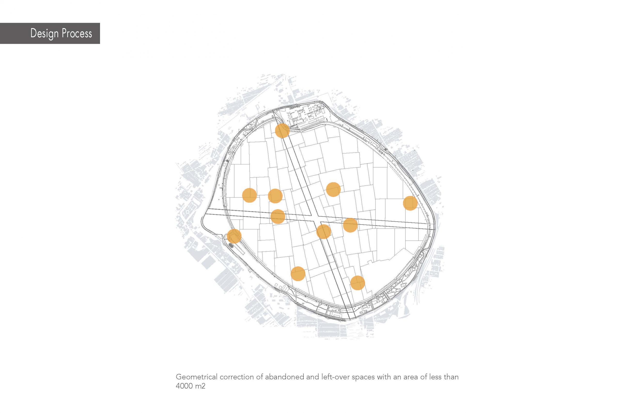
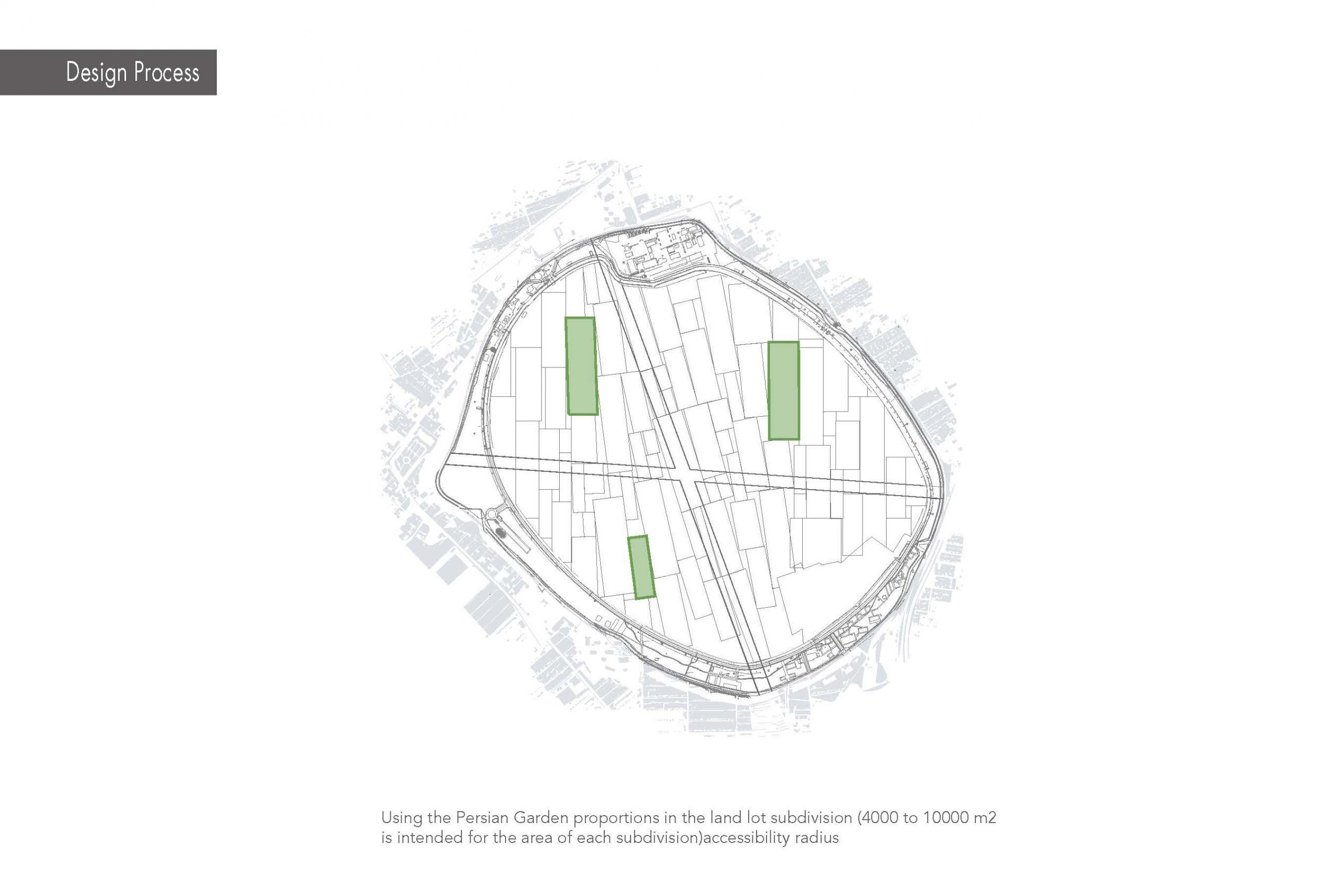
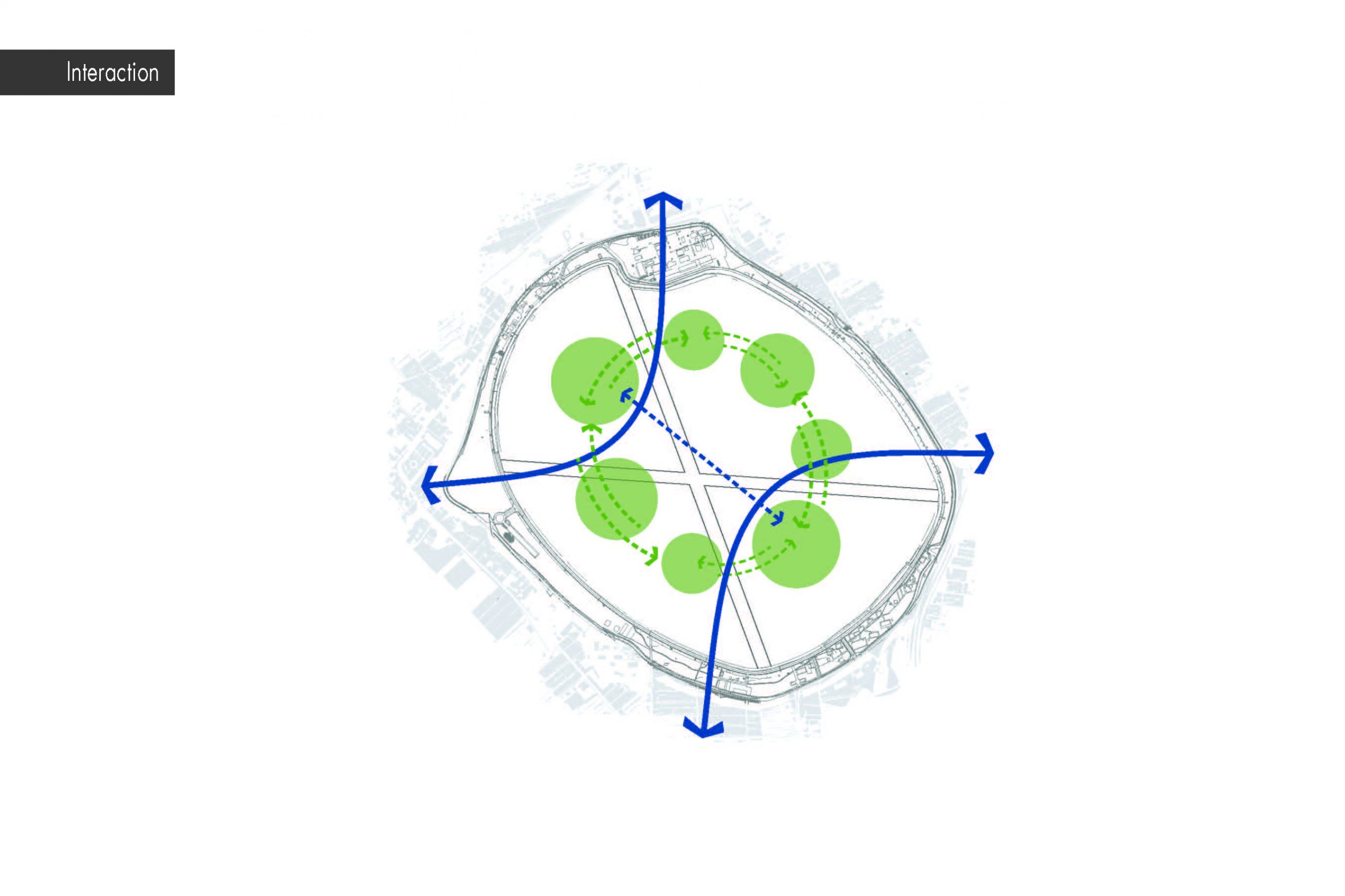
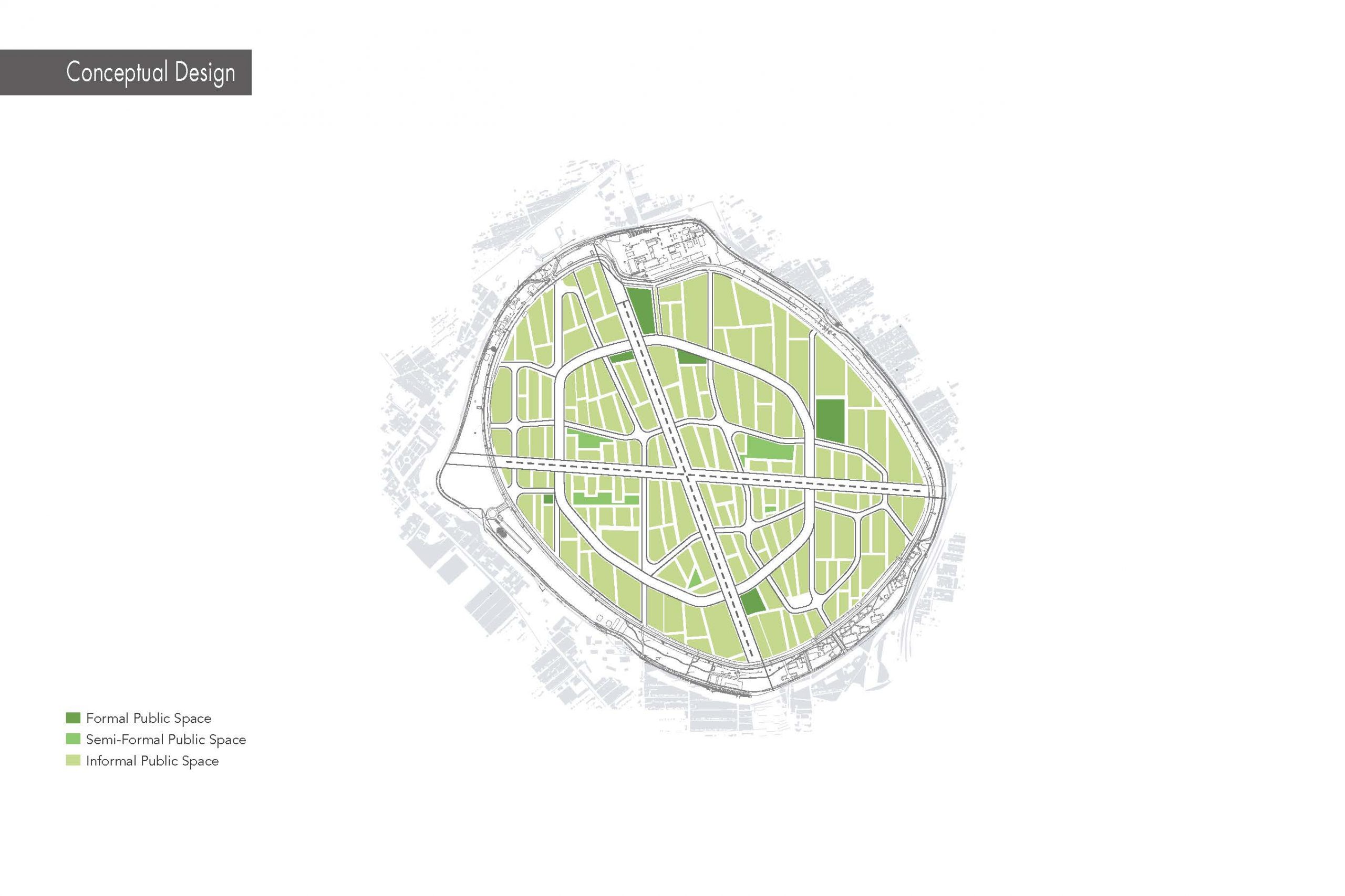
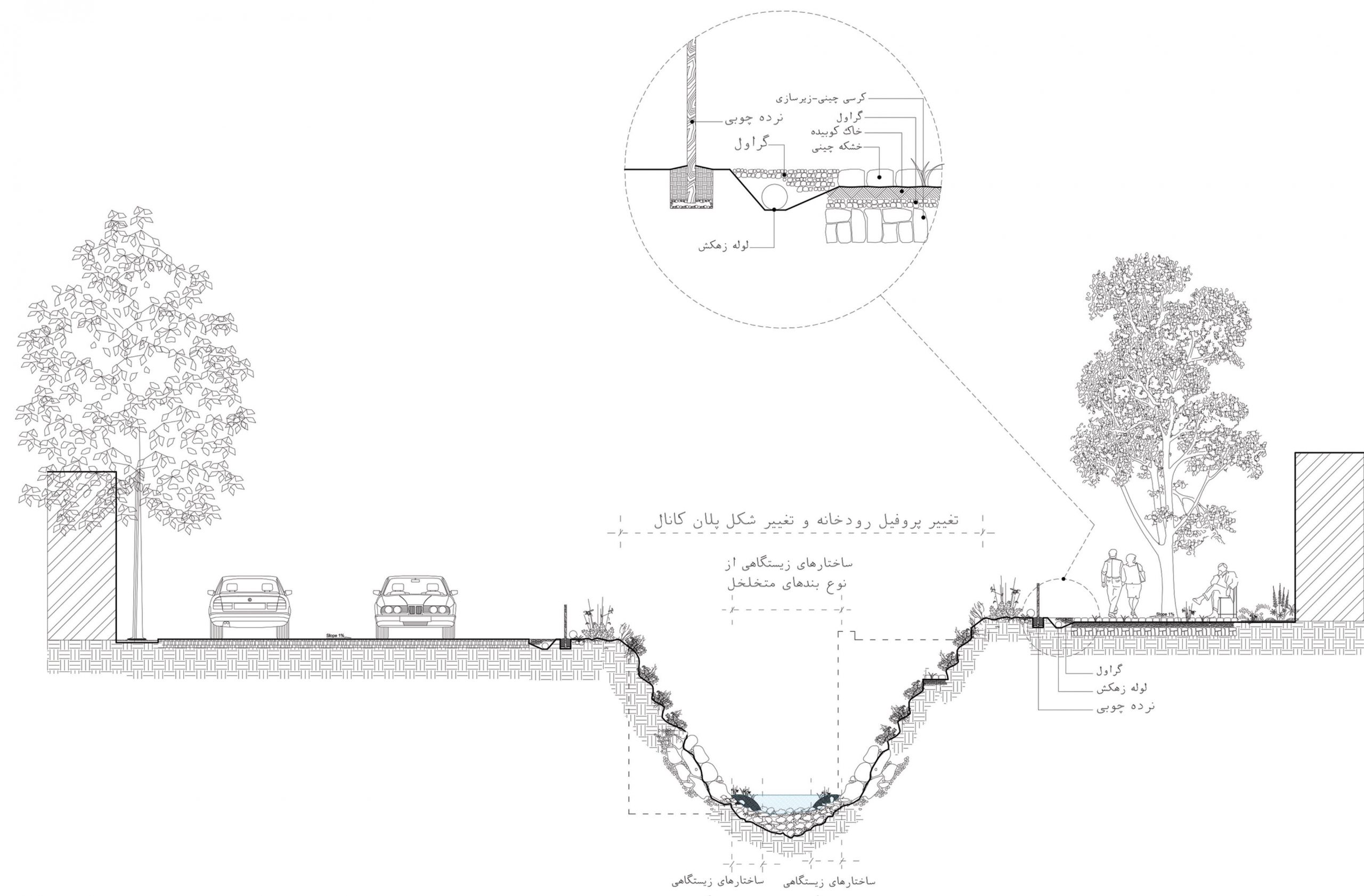
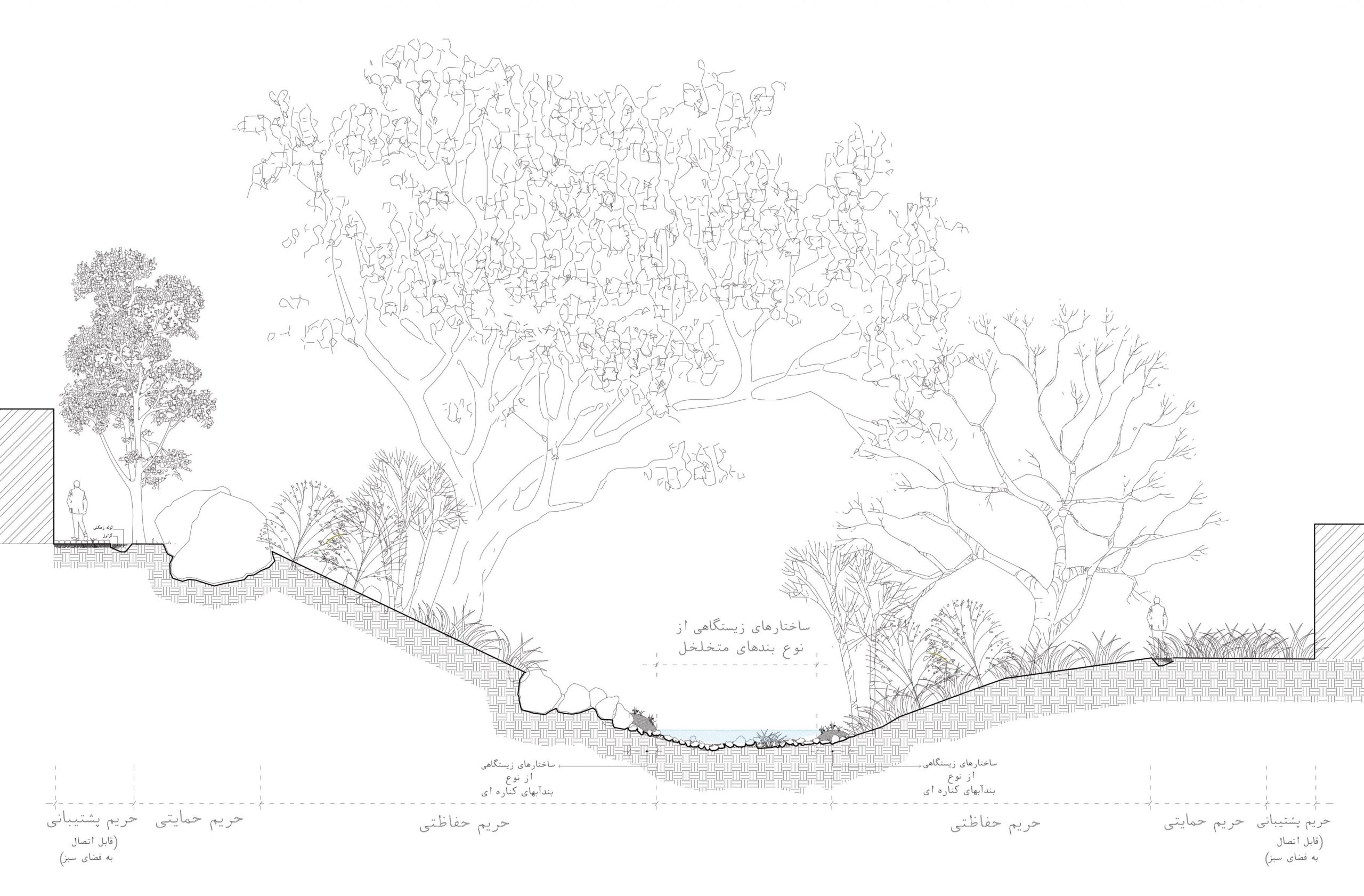
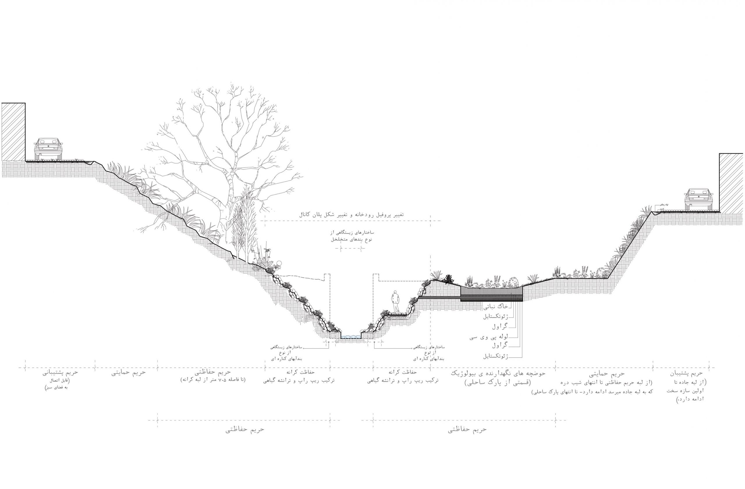
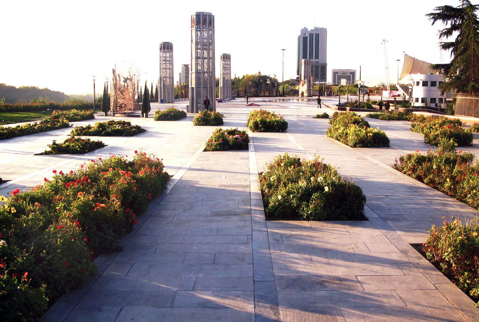
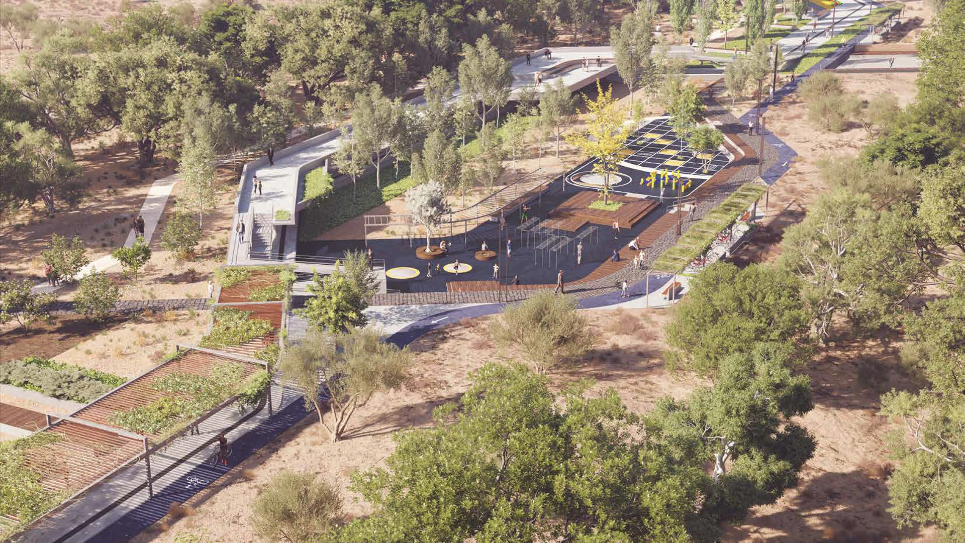
Hence, design team tried to create a chain of activities and at the same time a memorable sequence of spatial experience to achieve through time. A prominent feature to be named is the Green Belt and the Arboretum in the outer layer of the site, inspired by vernacular concepts of the Iranian garden, which address climatic control and filtration as well as creating a lively place for visitors. The green belt penetrates the site through the central Green Corridor designed as a conceptual trajectory starting from tradition to the new frontiers of innovation.
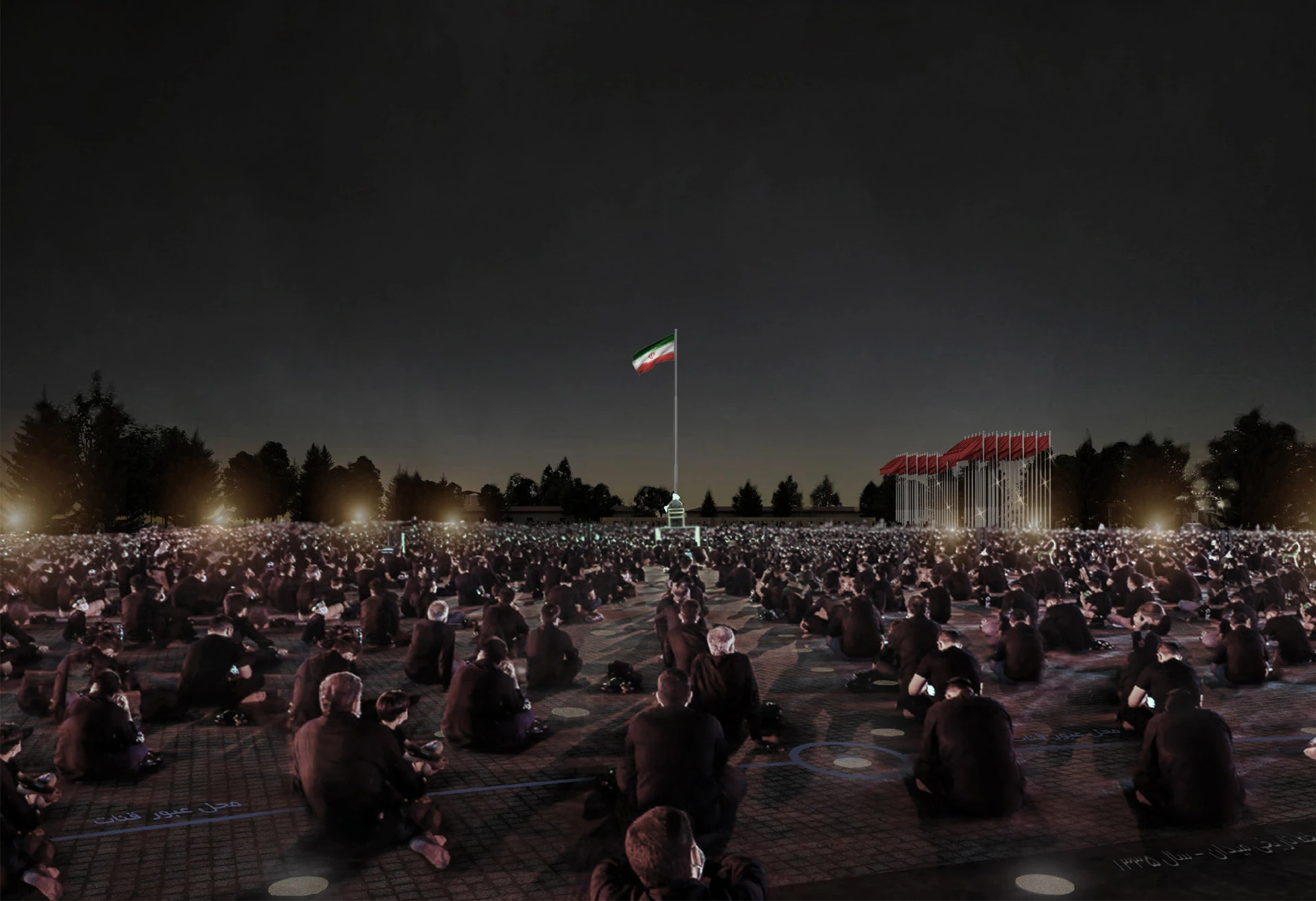
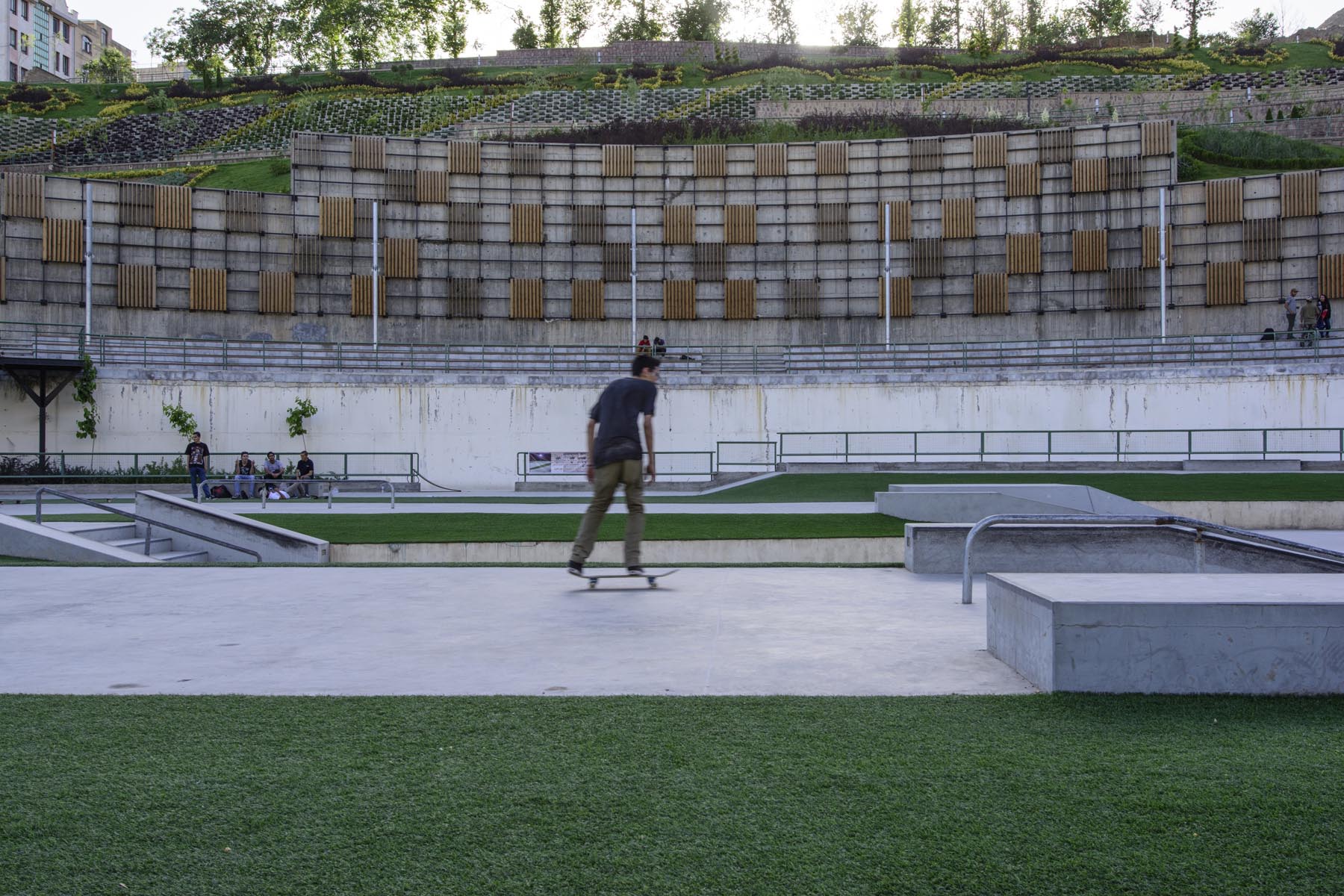
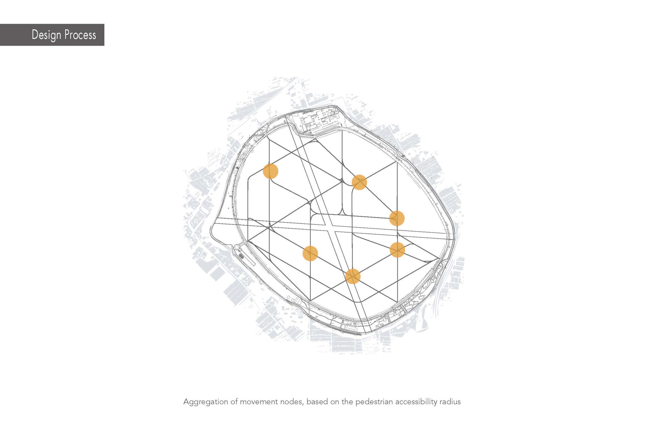
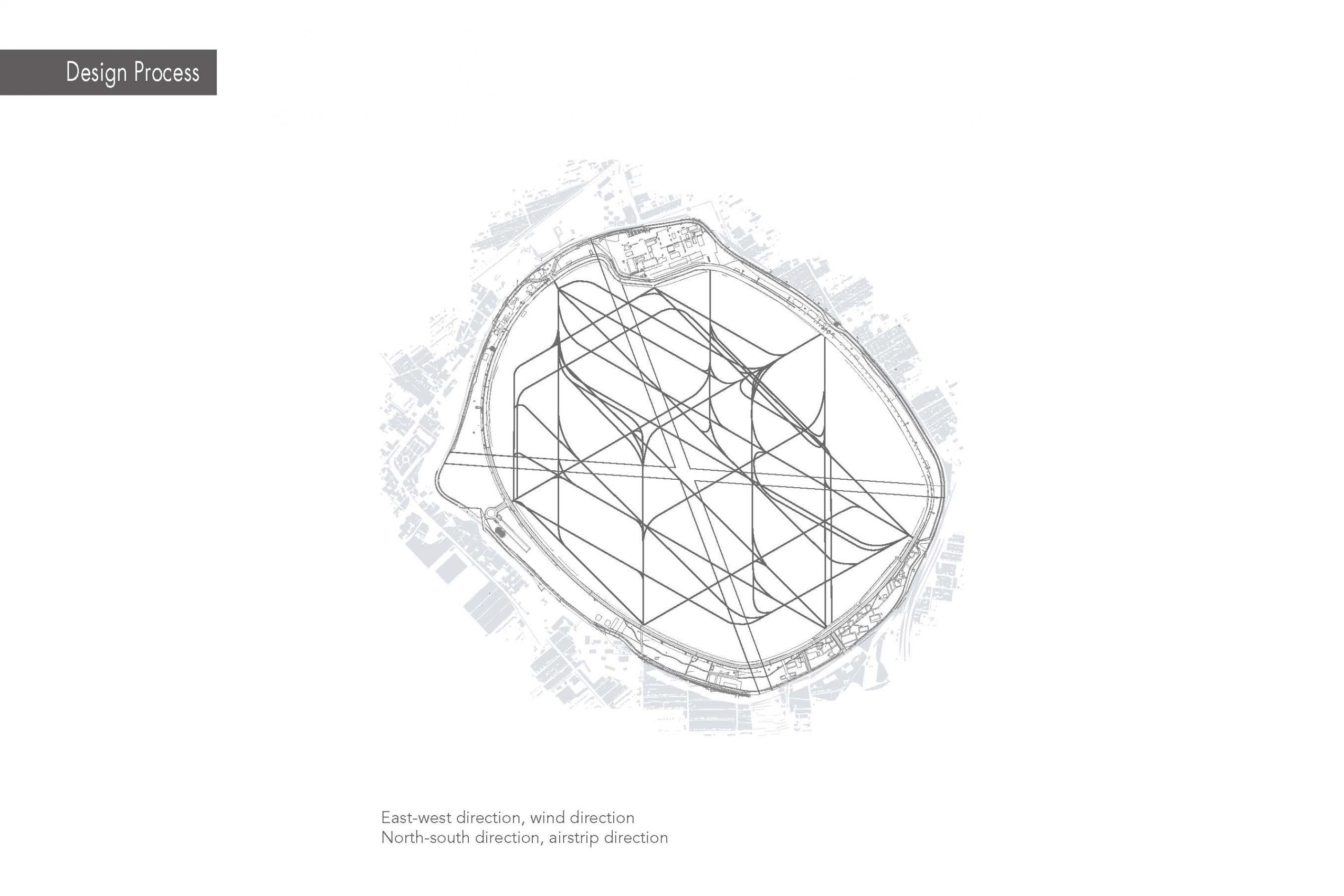
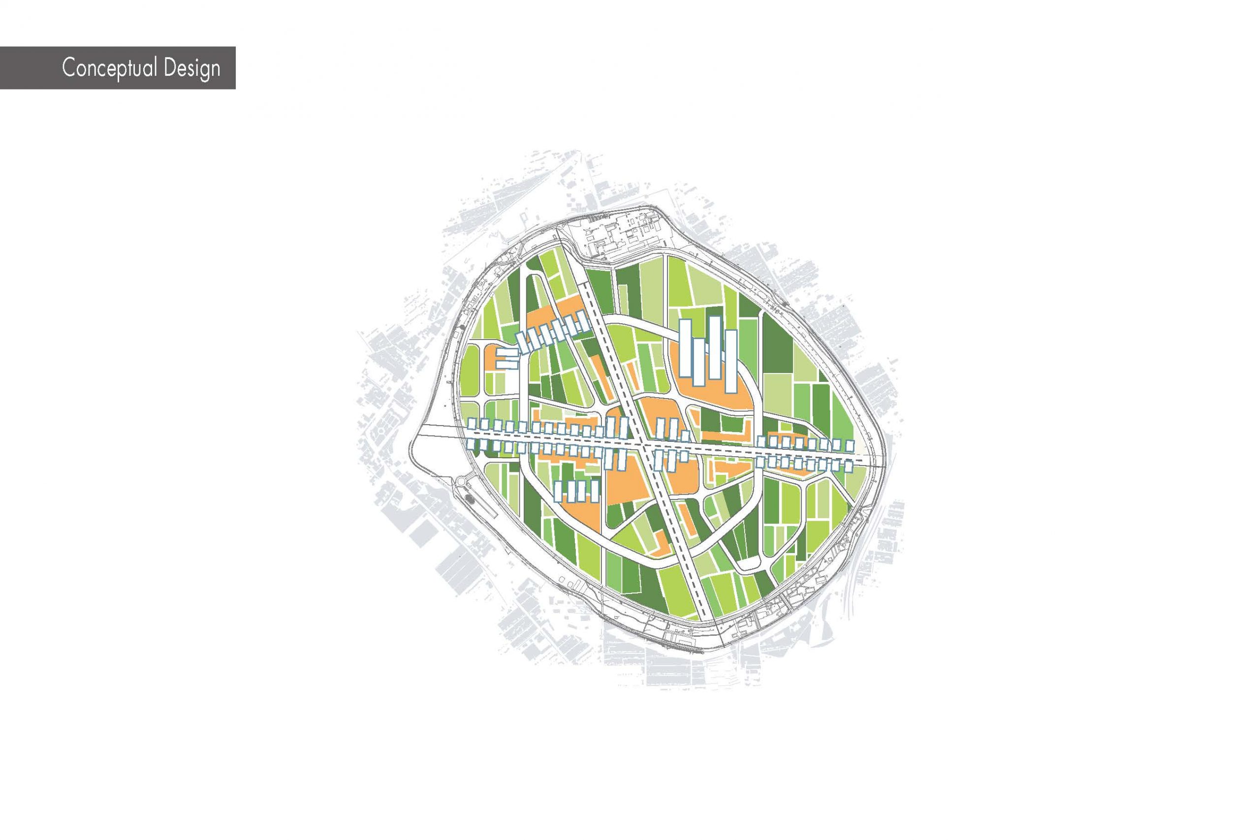
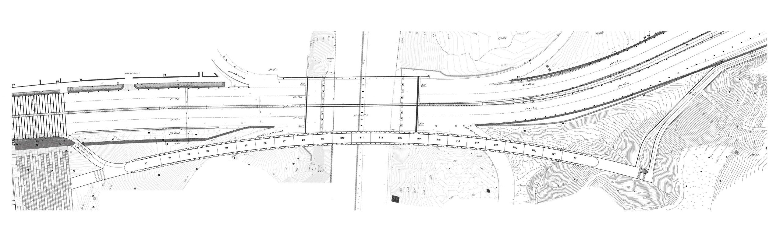
Planning for activities goes beyond the merely exhibition functions. Here, the site is envisioned as a mixed and multi-functional sustainable urban space. In addition to holding domestic and international fairs, the site is planned to offer a vivid range of tourism, recreation and leisure opportunities, active for 24/7. This pedestrian-friendly complex is ready to connect to the historical city through the same shuttle vehicles it provides for visitor to move around the site. The sequences of receiving light and shadow through the open areas by means of trees and supportive elements are designed to make walking and wandering a possible mode of transport within the entire site.
Although the Spatial Master Plan may seem a more tangible and sightly deliverable, yet the BDP, comprises FS studies, planning for existing and possible cooperation networks, setting strategies for revenue streams, considering development trends, and communication models has had a direct impact on physical and spatial planning. Analyzing the business environment, defining services to provide, marketing and organizational planning at a strategic level, and identifying and analyzing the risks to the business are the main activities taken in this part of the services of this project.
موضوع اصلی طرح نمایشگاه بینالمللی یزد توسعه زمینی بزرگ مقیاس به وسعت 56 هکتار است که در جنوب و حریم شهر تاریخی یزد واقع شده. مأموریت ما در این پروژه تهیه طرح توسعه کسب و کار، طرح جامع فضایی و طرح منظر فضاهای باز این محدوده به منظور خلق یک مرکز جدید با محوریت کسب و کار نمایشگاهی در پیوند با شهر یزد بود. با توجه به ماهیت عملکرد نمایشگاهها به عنوان نقطه عطفی برای ملاقات، تبادل و تعامل انواع کسب و کارها هم در سطوح تخصصی و هم در بخشهای عمومی، توسعه این طرح در چشمانداز خود و با بهرهگیری از ظرفیتها و امکانات شهر، علاوه بر توسعه شرکت نمایشگاههای تجاری شهر یزد، محرکی برای رشد و توسعه انواعی از فعالیتها و افزایش تقاضای توسعه زیرساختهای موجود در شهر، به خصوص آن دستهای خواهد بود که سرشتی سازگار یا مکمل فعالیتهای نمایشگاهی دارند. مهمترین دغدغههای نشا در تدوین فرآیند تهیه طرح جامع یا ارزشهای طرح، عبارت از حفظ پیوستگی و انسجام اجتماعی و ارتباط مؤثر با جامعه محلی، شناسایی و زمینهسازی برای رشد اقتصادی متوازن و دارایی محور شرکت نمایشگاهها و منطقه شهری پیرامون، و ایجاد هویتی معتبر و متناسب با موقعیت ویژه سایت در نزدیکی شهر تاریخی یزد بود. توجه به پایداری اکوسیستم و سازگاری با فرایندهای طبیعی نیز اصلیترین ارزش زمینهای مفروض و مسلّم در طرح است. طرح توسعه نمایشگاه در دو محور اصلی طراحی مدل بیزنسی با هدف نقشپذیری و رقابت در سپهر کسب و کار نمایشگاهی؛ و طراحی و برنامهریزی توسعه کالبدی- فضایی سایت با هدف ایجاد و آمادهسازی بستر توسعه کسب و کار و همچنین ایجاد ارزش افزوده در سایت در اختیار شرکت نمایشگاهها به عنوان یک مزیت رقابتی در برگزاری رویدادهای تجاری، فرهنگی و گردشگری است. با توجه به نیازهای کارفرما و تجزیه و تحلیلهای انجام شده در دیسیپلینهای مختلف، تیم طراحی اقدام به ایجاد یک زنجیره کامل عملکردی و در عین حال توالی به یاد ماندنی از تجربه فضایی در فازهای زمانی کوتاهمدت، میانمدت و بلندمدت توسعه سایت نمود.
یکی از ویژگیهای بارز این پروژه پیشنهاد کمربند سبز و آربورتوم در لایه پیرامونی زمین است که با الهام از معماری بومی یزد و باغ ایرانی ارائه شده و علاوه بر کارکرد اقلیمی و تعدیل هوا به عنوان فضایی سرزنده و عملکردی سلسله مراتبی از تجارب مختلف را در مقیاس پیاده در اختیار بازدیدکنندگان قرار میدهد. کمربند سبز بوسیله باغراه مرکزی به درون سایت نفوذ میکند و با سناریوسازیهای مبتنی بر تکنولوژی به عنوان قلمرو بین سنت و مرزهای جدید نوآوری عمل میکند. اما طراحی اقلیمی و استفاده از تکنولوژی در فضاها تنها جنبههای منحصر بفرد این پروژه نیستند. رویکرد طراحی برای نمایشگاه بینالمللی یزد فراتر از کارکرد نمایشگاهی میباشد. در این کانسپت سایت نمایشگاهی به عنوان یک فضا و مکان پایدار شهری مختلط و چندعملکردی پیشبینی شده که علاوه بر برگزاری نمایشگاههای داخلی و بینالمللی، طیف گستردهای از فضاهای گردشگری، تفریحی و فراغتی شهر یزد را تأمین میکند و فضاهای هیبرید و سرزنده آن در تمام طول سال و ساعات شبانه روز فعال خواهند بود. این مجموعه دوستدار پیاده با استفاده از خطوط شاتل امکان ارتباط با شهر تاریخی یزد و همچنین جابجایی در سایت نمایشگاهی را فراهم میکند.
با توجه به مکانیابی کاربریها و همچنین بهرهگیری از تکنیکهای نور و سایه و سایبانها در طول مسیرها امکان پیادهروی در تمام سایت وجود دارد. در طراحی سازمان فضایی، لکهگذاری کاربریها و پیش بینی فرم کالبدی و فضاهای همگانی، تلاش شده است قرائتی امروزین از سنت غنی معماری کهن یزد ارائه شود و به تأسی از روشهای کنترلی غیرعامل، با رعایت جهتگیریهای مناسب، توجه به سایهاندازی و نورگیری بهاندازه، شرایط آسایش اقلیمی در جهت افزایش حضورپذیری فضاهای باز برای کاربر پیاده فراهم باشد. گرچه برنامه توسعه کالبدی- فضایی و روند پیشرفت آن خروجی ملموستر این پروژه است، باید توجه داشت که پیشران آن برنامه توسعه کسب و کار، از امکانسنجی تحققپذیری زنجیرههای فعالیتی با اتکا بر مزیتهای نسبی وابسته به جغرافیای کسب و کار و شبکههای همکاری موجود و قابل شکلگیری گرفته تا بررسی کانالهای درآمدی، گرایشهای توسعهای، و مدل ممکن برای پاگرفتن و تداوم کسب و کار بوده و تأثیری مستقیم بر برنامهریزی فضایی و کالبدی داشته است. تحلیل محیط کسب و کار و تبیین خدمات قابل ارائه، برنامهریزی بازاریابی و سازمانی در سطح استراتژیک و شناسایی و تحلیل ریسکهای متوجه کسب و کار اقدامات اصلی انجام شده در این بخش از خدمات این پروژه است.